
Berner Oberland 2002, part 3
Lauterbrunnen
Day 7 – Thurs 1 August
Down
Up at 0700 – more snow overnight, no freeze – breakfast – down to Jungfraujoch station for first train (0900) – Kleine Scheidegg – Lauterbrunnen – collect bags forwarded from Meiringen – to tourist office to book hotel room – Hotel Oberland – shower, shave, clean clothes – beers – lunch.
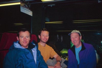
Chris, John, Tony in the train down. (Photo – Chris)
Today was Swiss National Day, and the village was celebrating with Rösti Week. Chris was feeling lard withdrawal symptoms, and opted for the Trucker’s Rösti, which came with bratwurst, fried egg, and extra lard. Surprisingly, he was still conscious by the end of it. John and I chose more modestly (well, slightly).
Fireworks
That evening there was a parade through the village, followed by fireworks. There were some private contributions, but the official event took the form of rival displays. First to go was Wengen, high on the rim of the valley. A spectacular display lasting about 10 minutes. Then a similar effort from Mürren on the opposite side. Finally Lauterbrunnen showed what it could do – a third magnificent display with the added refinement of the bangs and explosions reverberating across the narrow valley.
Mountain bikes
Day 8 – Friday 2 August
Mechanic
This was John’s last day, and it was he and Chris who persuaded me that a day’s mountain biking would be fun. The bike shop is next to the Hotel, and after paying we went upstairs to see Ricky, the Ozzie bike mechanic. “Whereya going?” he wanted to know. We told him – bikes on the train to Wengen, up to Kleine Scheidegg, down to Grindelwald, on down to Zweilütschinen, and back up to Lauterbrunnen. “Yerregular bikers?”, he asked, looking particularly at me and thinking, I suspect, that the old man – probably the father of one of the two lads – wouldn’t make it to Kleine Scheidegg. “Sure”, we said. “OK”, he shrugged, “come and look at the bikes.” We could tell he didn’t believe us.
Tourist
The road from Wengen is tarmac at first, then changes to a dirt road. The first part is the steepest, and the first few kilometres had us panting in near bottom gear. Once the gradient eased we began to enjoy the ride. The times on the signposts to Kleine Scheidegg gradually got shorter. We weren’t in any hurry and stopped a few times for a break. A Japanese tourist following the shorter walking path from Wengen passed and re-passed us a few times.
With Kleine Scheidegg in sight, Chris was out in front, then John, then me. The very last few metres of the track are very steep, and in turn we each charged at the slope in super-granny gear, just making it to the top. I passed the Japanese tourist on the way.
Brakes
We had lunch at the excellent Eiger Nordwand mountain restaurant a couple of hundred metres from the frenetic crowds at the station. And then off for the big downhill – an endless swooping, bumping and jarring down the track towards Grindelwald. Brakes were tested to the full, but Ricky had clearly done a good job and no-one had any problems. Finally down into Grindelwald Grund on the tarmac road.
The downhill continued, though less steeply. A dirt road follows the river valley, with occasional sections on the main road. A group of lycra-clad Germans looked askance at our outfits – sweaty t-shirts, rolled-up trousers (well, I wasn’t going to get grease all over my walking trousers), old trainers. We played leapfrog with them, and eventually saw them off convincingly on one of the road sections.
Turn
In our downhill euphoria we missed the sharp turn at Zweilütschinen and ended up in Gsteigwiler before realising we’d gone wrong. We turned back, retraced, and eventually rolled back into Lauterbrunnen to surrender the bikes to Ricky. He looked up from oiling a sprocket as we walked in.
“Howdya get on?”, he asked, looking at our sweat-soaked clothes and the dust-covered bikes.
“Fine. No problems.”, we replied, “It’s a good route.”
“Y’made it, then?”
“Yeah.”
Did we detect a trace of respect in Ricky’s face after his doubts of the morning? Probably not.
Prizes
Later, we awarded ourselves champions’ prizes.
| Champion uphill, off-road | Chris |
| Champion downhill, off-road | John |
| Champion downhill, on-road | Tony |
Statistics
| Total height gain/loss (m) | +1025 / -1470 |
Schilthorn (2970m)
Day 9 – Saturday 3 August
Traverse
Just Chris and me now – John had left early in the morning to meet a friend in Zurich and go climbing in the Dolomites. The two of us had already decided to climb the Schilthorn, starting from Mürren. We’d do a traverse of the mountain, going up the tourist path which ends on the SE ridge, and coming down the W ridge. We opted to travel light – one rucksack between us, and approach shoes instead of Alpine boots.
The weather was fair and warm when we set out from Mürren, where the signpost showed 4h 15min to the summit. Cloud came and went over the surrounding tops. The track, tarmac at first, then unsurfaced, follows the route of the Schilthorn half-marathon, the “Inferno”. Major pipelaying works had churned up large sections of the route.
We were rather warm when we reached the Schilthorn hut, and stopped for a drink before carrying on. The driveable road continues for a while, but eventually comes to an end and the path continues more steeply over rocks. One or two sections have steps cut in the rock, and there is a narrow section on the final ridge approach to the summit.
Cloud
The top was in cloud by the time we arrived, but we’d made good time. I’d hit the wall at about 2700m, but still clocked 2h 45min with the stop at the hut. Chris had taken about ten minutes less.
We had a quick look round the crowded public areas, waited an age to buy a coffee at the bar, and had our lunch in a corner set aside for picnickers. We resisted all opportunities to buy James Bond themed merchandise (Schilthorn, aka Piz Gloria, is the one with the revolving restaurant).
Thunder
It was raining by the time we left, and the cloud had thickened into a dark grey mist. We headed off along the W ridge towards a small col known as Rote Härd, about a kilometre and a half away. The first crack of thunder came a few minutes later. The manual says “Get off the ridge”, but that didn’t seem such a good idea. To the right was a near-vertical drop. On the left a steep slabby scree slope disappeared into the murk, threatening a drop to who-knows-where. Back? Just as dangerous as going on. We went on as fast as we could.
The rain got heavier, and a second clap was closer than before. No lightning, though. Keep going, watch your feet, don’t fall, don’t slip. Where’s the col? A third crack, almost overhead, and a sharp sting on the top of the head beneath hood and cap. Still no lightning. Good thing we’d got no metal tools with us. And at last a signpost indicating the route down.
Descending as quickly as we could, the rain eased but we were drenched. Although we’d brought waterproof tops, neither of us had overtrousers. Losing height we came out of the cloud, and gradually the rain stopped and we began to dry out. By the time we got to the Rotstock hut the sun was shining. Inside, we took stock: no damage, though stuff in the rucksack was pretty wet, including the map. We wrung out our socks, spread the map out to dry, and ordered hot chocolate. The Schilthorn restaurant, 931 metres above us, glinted in the sunshine.
Statistics
| time | altitude(m) | distance(km) | |
|---|---|---|---|
| Mürren | 1030 | 1638 | 0 |
| Schilthorn hut | 1135(a) 1155(d) |
2432 | 4 |
| Schilthorn summit | 1315(a) 1405(d) |
2970 | 7 |
| Rotstock hut | 1510(a) 1545(d) |
2039 | 11 |
| Mürren | 1700 | 1638 | 16 |
| extra ups & downs | – | 73 | – |
| Total height gain/loss (m) | 1405 | ||
| Total time | 4h 45m (plus stops) | ||