Berner Oberland 2002, part 1
Introduction
Before we start . . .
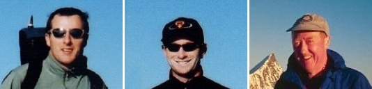
We met up at Zurich airport – Chris, John and me. John and I were an hour and a half late thanks to Easyjet, so we’d missed our connecting train that would have got us the last bus to the Grimsel pass. Chris had travelled BA from Machester, and was waiting for us.
Chris and I were by now well-established Alpine partners (see previous years’ reports). John, from Kendal, was a long-time climbing friend of Chris. This was his first trip to the Alps, and he was looking forward to using his brand new crampons – complete with mean-looking serrated teeth.
The three of us had got together a few weeks earlier for a training weekend in Snowdonia, where John had been nursing a sprained ankle, and I’d ended up in A&E at Bangor hospital with a badly damaged finger. John’s ankle was still tender, and I had a black leather finger stall to protect my still swollen and inflexible ring finger. Chris was in his usual superfit state of robust health, but John and I agreed he could tag along if he carried the rope.
Our plan was to try again to complete the route that Chris, Agnès and I had wanted to do last year – a traverse of the Berner Oberland starting at the Grimsel pass and ending in Lauterbrunnen. On the way we planned to climb the Finsteraarhorn, Fiescherhorn, Jungfrau, Mönch, and possibly the Eiger. The story of that trip is in last year’s report.
Berghaus Oberaar – Oberaarjoch hut
Day 1 – Friday 26 July
Walk-in
When I’d originally phoned the guardian at the Oberaarjoch hut to book us in for Friday and Saturday nights I’d also asked what time most people left the Berghaus Oberaar to walk up to the hut. “Any time”, I was told.
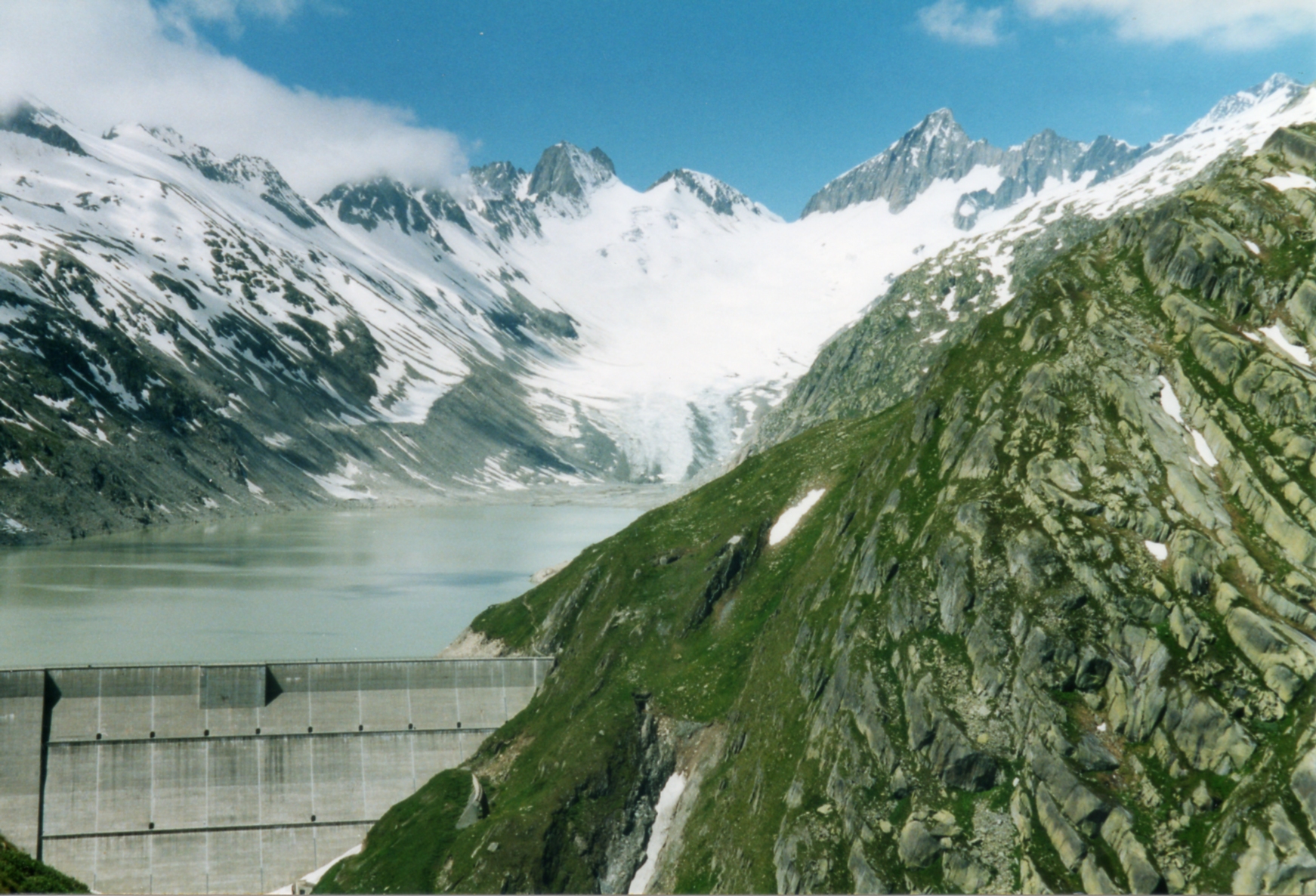
So now we were at the Berghaus we wouldn’t need an alpine start. We had a leisurely breakfast at seven, and it was twenty past eight by the time we hoisted our sacks loaded with kit for nine days in the mountains and set off down the steps to cross the dam. The morning was cool, with cloud blowing around in the valley and over the nearby summits, but the forecast was for improving weather and high pressure building.
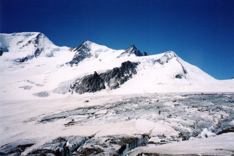
We followed the more-or-less level path along the north side of the lake. It takes about an hour to get to where the tongue of the Oberaar glacier feeds into the moraines at the head of the lake, and the path starts to rise. Soon after, we took the opportunity to get onto the glacier itself, here dry (no snow covering).
Oberaarjoch on the skyline at the head of the glacier
Glacier
Despite John’s disappointment that he wouldn’t get to use his new crampons yet, we scrunched in boots over the gravel-and grit-covered ice keeping within sight of the right-hand edge of the glacier. Our objective, the Oberaarjoch, which had been in clear view earlier, had disappeared in the mist and cloud. Looking back we could see a large group following us, but as the mist closed in on us and visibility dropped to about 50 metres we lost sight of them.
Climbing gently, we crossed several low piles of rock – remnants of rockfalls from higher up being gradually carried down by the glacier. Then a larger pile, more like a rocky ridge, loomed through the murk. John and Chris were tending too far left for my liking – I was intent on keeping right, closer to the edge of the glacier. We took different routes across the rocks, then rejoined. Time for the map and compass, we agreed. A quick check gave us the right line, but we kept the compass handy for reassurance.
As we gained height snow patches started to appear on the glacier. We avoided the smaller ones, but before long there was more snow than bare ice, and then the first crevasse across our route. Time to rope up.
Company
As we put on harnesses, tied on and took coils, the people we’d seen earlier appeared through the mist. They stopped as well. They were a group of 8 Swiss, who formed themselves into two ropes of four. We all set off at the same time, and started to pick our way through a zone of transverse crevasses. Most were narrow enough to step across, but a few were wider with limited crossing points. We and the Swiss started to get in each others’ way, and in the end we claimed space on the heels of their first rope, with the others following behind us.
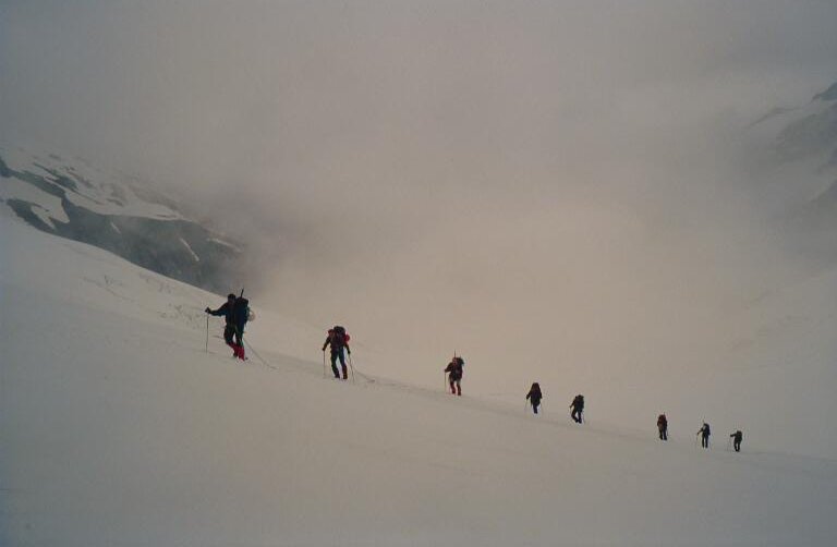
Our companions on the glacier (Photo – Chris)
We made steady progress, and the mist started to clear. From time to time we could see the col, and by 1130, when we had been on the glacier for about two hours and were well over half way, it had cleared completely.
As we and the Swiss paused occasionally for a breather we played leap-frog with their two groups, and by the time the col was within reach of a final push we were at the front. And that’s how we arrived at the col.
Hut
There was no problem finding the hut – a case of “you can’t miss it” on the rocks a few metres above and to the right of the col. We squeezed into the tiny boot room, already overcrowded with four other people in it, and then into the common room to report in. The guardian was disconcerted – yes we were expected, but only for tonight. They were already over-full for Saturday night, and some people had been told they’d have to sleep on the floor. I pointed out we’d booked by phone for two nights, but it seemed that language problems had led to a misunderstanding.
We were given sleeping spaces for the night, though, and between ourselves we reckoned that possession was nine tenths of the law. We’d leave some kit in the spaces, and wouldn’t move unless forced. The strategy worked, and nothing more was said.
Etiquette
Just one final comment about that night. The Oberaarjoch hut is very popular at weekends – it’s easy to get to, and the Oberaarhorn is a straightforward climb with splendid views. The prospect of sunrise on the summit attracts people who would not normally stay at more inaccessible huts. Hut etiquette was badly observed – loud conversations after lights out, prolonged kit sorting in the dormitory, large helpings of food grabbed before everyone had had their chance. A pity, because as somebody said to us a few days later, “It doesn’t show us Swiss in a very good light.” True, and fortunately a rare problem in our experience.
Statistics
| time | altitude(m) | distance(km) | |
|---|---|---|---|
| Berghaus Oberaar | 0820 | 2338 | 0 |
| Oberaarjoch hut | 1305 | 3256 | 8.5 |
| Total height gain/loss (m) | 918 | ||
| Total time | 4h 45min | ||
Oberaarhorn – 3631m
Day 2 – Saturday 27 July
Breakfast
The hut guardian had explained that “most people” set off about 5 o’clock so as to be on the summit for sunrise. Then they come back down to the hut for breakfast. It seemed a reasonable idea, so we decided to do the same.
Despite that, there was some breakfast on the tables when we got up at 4.30. Chris and John grabbed some muesli and some bread and jam while I explained to the guardian we’d have ‘proper’ breakfast later. The guardian didn’t seem bothered. We finished getting ready and left the hut at 5.15.
Blurred
My memories of climbing the Oberaarhorn are blurred and confused, which is how I usually feel in the early mornings. The path to the summit via the normal route starts behind the hut toilets, initially up a series of slabby ledges, and is liberally marked with large arrows and paint splodges in dark orange. The quality of the rock on the first half of the climb varies, with plenty of loose shale among the more solid sections.
The upper part of the route is a simple snowfield at a moderate gradient. We alternated between zig-zagging and heading straight up, hardly remarking on the christening of John’s crampons. There’s little variety on the snow slope and the summit comes into view without warning. Oddly, a couple of metres of snow on the summit put us level with the top of the summit cross.
Panorama
“Most people” were right, though. The panorama from the summit as the shadows fell away was worth the climb. The east face of the Finsteraarhorn loomed close on the other side of the valley, with the sun catching its upper slopes. To the south the peaks of the Mischabel and Monte Rosa stood clear above a layer of valley cloud, with the Matterhorn doing a Toblerone impression further west. We took pictures.
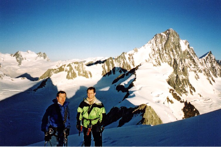
Chris & John on summit of Oberaarhorn, Finsteraarhorn behind
Later
Back at the hut an hour later we helped ourselves to bread, jam and cheese, and bowls of tea, and discussed plans for the rest of the day. We’d considered a traverse of the Vorder and Hinter Galmihorns, and even though we thought both might be a bit too much, we agreed to go and have a look. From the Galmigletscher the NW ridge of the Vorder Galmihorn looked off-putting – heavy snow accumulations piled over the ridge, and big complex crevasses away from the ridge edge. Instead, we headed for the Galmilicke, the col north of the Hinter Galmihorn, a glacier walk away.
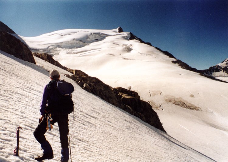
Chris checks out the Vorder
Galmihorn (photo – John)
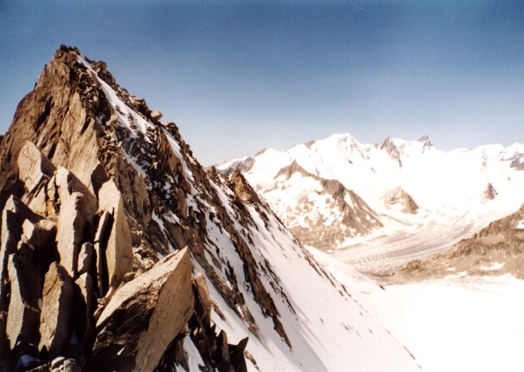
The chossy ridge on the Hinter
Galmihorn (photo – John)
Once at the col we started on the ridge towards the summit. This was mostly loose and crumbling rock, about 45 – 50 degrees. As we got higher I decided I was not enjoying it, and called a halt. John and Chris went on while I waited. My altimeter showed 3410 metres, 56 metres below the summit. John and Chris got as far as the fore-summit, but didn’t like the look of the final summit ridge and decided enough was enough. It was down and back to the hut. Our excursion had added 546m of ascent and descent to the day, making 920 metres in total.
Statistics
| time | altitude(m) | |
|---|---|---|
| Oberaarjoch hut | 0515 | 3256 |
| Oberaarhorn | 0630 | 3631 |
| Oberaarjoch hut | 0730 | 3256 |
| Total height gain/loss (m) | 375 | |
| Total time | 2h 15min | |
Finsteraarhorn hut
Day 3 – Sunday 28 July
Névé
An easy walk today, over the Gemslicke col to the Finsteraarhorn hut. We left the hut at 0640, after sunrise, but with the route over the Studergletscher and up to the Gemslicke still in shadow. We made good time on firm névé and easy slopes up to the col. The view back to the Oberaarjoch and Oberaarhorn, with the sun low in the sky, was splendid.
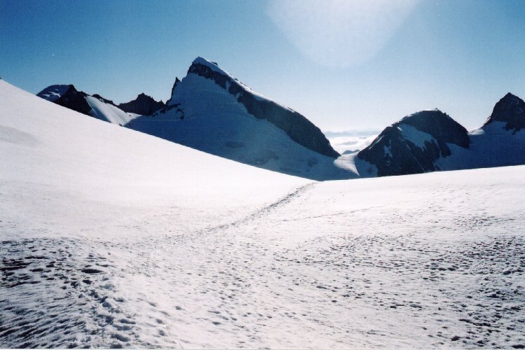
Early morning view of Oberaarhorn and Oberaarjoch
Drop
The view the other side came as a surprise, though. While our way up had been over easy firm snow, the other side of the col dropped sheer out of sight down a scree and rubble filled couloir. We unroped, and spent a few minutes taking photos before setting off.
The descent didn’t seem too bad at first. The path was over soft, loose scree, but we were all used to moving on that kind of terrain. The main danger was stonefall – it was impossible not to dislodge loose stones every few steps, and the couloir funnelled everything down onto the path below.
Crampons
A little way down we heard people coming up, and waited for them to reach us. They nodded as they passed, out of breath with the steep gradient. But they were wearing crampons!! On scree?? What school of alpinism was this? We soon found out.
John was ahead, and Chris and I had stopped so as not to knock any stones down on him. Suddenly he stopped too, turned and shouted something we couldn’t quite hear. He then started inching his way gingerly down, turning to face into the slope. What was going on, we wondered? Eventually he made it to a less steep strip of moraine rubble, and stopped. I started down to join him.
Ice
I’d just reached the narrowest part of the couloir when the puzzle was solved. The thick scree was suddenly no more than a thin covering over solid ice. Not the crunchy, gritty surface of a dry glacier, but loose shale and pebbles on ice. Moving without slipping was almost impossible, as John had found. At least it explained why the people we’d passed were wearing crampons.
By the time we’d all found somewhere safe to put on our own and had descended the last 50 metres or so to the end of the couloir, the short section of the route down from the col had taken us longer than the 2.5km from the hut to the col.
The rest of the way to the Finsteraarhorn hut was uneventful, although the glacier immediately below the hut is quite badly crevassed. We took to the lateral moraine at one point, but this was if anything more risky than the glacier with a good chance of slipping on the loose rubble.
Crevassed glacier below the Finsteraarhorn hut
Statistics
| time | altitude(m) | distance(km) | |
|---|---|---|---|
| Oberaarjoch hut | 0640 | 3256 | 0 |
| Studergletscher | 0650 | 3080 | 0.5 |
| Gemslicke | 0740(a) 0800(d) |
3335 | 2.5 |
| Fieschergletscher | 0950 | 2820 | 3.8 |
| Finsteraarhorn hut | 1050 | 3048 | 5.5 |
| Total height gain/loss (m) | +483 / -691 | ||
| Total time | 3h 50m (+20m) | ||