Alpes-Maritimes – Part 1
18 – 19 April 2005
Introduction
The soft green glow from the backlight of my watch showed me the time – 1.16 in the morning. I’d been in bed since before ten, and just woken for a moment. As I turned over and drifted back to sleep, an Important Thought came to me: the trouble with this walking holiday in the Alpes-Maritimes was that there weren’t any level bits!
But to go back to the beginning . . .
Jonathan and I had been talking about a week’s walking holiday in April somewhere in continental Europe. It had to be somewhere neither too hot nor too cold, with good food, reasonably priced hotels with en-suite rooms, hilly enough to be interesting but not too mountainous, and not plagued with mosquitos. The south of France seemed to fit the bill. I suggested the Cévennes, but Jonathan preferred the Alpes-Maritimes, on the grounds that it asn’t so remote and rural, and we could visit the local bars after our evening meal.
JT: Ah, yes, the naïveté of the long-distance walker.
I got the maps and worked out a possible route. “How do you fancy starting in the mountains and walking down to the coast? It’ll mean about four thousand metres of uphill.”
JT: The logic of this temporarily escaped me.
The Start
I’d found the timetable for the bus from Nice to St-Sauveur-sur-Tinée on the internet. I’d even e-mailed the bus company to confirm the details were up to date. “Definitely”, they said. “It leaves the main bus terminal in Nice at 0915 every day as long as the ski resorts are open.” A check with the Isola 2000 web-site showed the resort was open to the end of April. Probably.
Without the bus we’d be stumped. It was going to take us into the hills to the start of our walk back to the coast at Menton. If it wasn’t running we might be able to get a train some of the way, and hope for a taxi for the rest, but we’d never get to the start before mid-day at the earliest, if at all, and we had a 6-hour walk to get to the hotel we’d booked for that evening. A visit to the bus terminus the evening before had been fruitless – the information window was closed.
We got to the terminus at 0845 and went straight to the ticket office. Two tickets to St-Sauveur-sur-Tinée, one way? No problem. Relief! Just time to dash to the supermarket to buy bread, cheese, and sausage for lunch. The bus, with only a few passengers on board, left on time.
Introducing the GR52a
We walked back along the road for a couple of hundred metres, then stopped to pose for photographs by the first signpost on our walk.
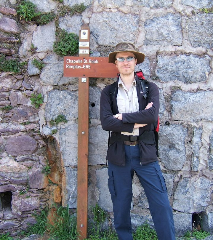
Jonathan at the Start
The GR52a, one of the national Sentiers de Grande Randonnée of France, skirts around the outside of the Mercantour national park in a generally east – west direction from Colmars in the valley of the Verdon to the Col de Tende in the corner of the French/Italian border. It was to be our companion for most of the next 5 days’ walking. Here it happens to coincide with the GR5, a Big Daddy long distance path which crosses France from North to South. With one or two exceptions, the white and red waymarks would be helping us with our route-finding.
On my new maps of the region I’d noticed an innovation. Small numbered rectangles indicated signposts, allegedly each numbered to correspond with the number on the map, or vice versa. I had been sceptical, but my doubts were misplaced. From this first signpost, number 167, to the last, with only one exception, the signposting system proved to be reliable and accurate.
We left the road and set off up a driveable track. A few metres further a white and red waymark directed us off the track onto a narrow path which climbed steeply up the hillside. It was a foretaste of things to come.
JT: Yep, a foretaste of the need to gulp copious amounts of water and remove all outer layers of clothing. Nothing like a gentle warm-up to ease ourselves into the kilometres that lay ahead; and this was nothing like a gentle warm-up.
Fermé
Seven and a half kilometres later, after 720 metres up and 190 metres down, our path became a sea of sandy mud. The village of la Roche was expanding, and the GR52a had been obliterated by construction work for what looked like a new factory and warehouse. It was hot, and although we had water the thought of a cold drink was very appealing. Navigating by instinct through the mud we picked up the path again, but then detoured to go into the village centre. Everywhere was shut except the tourist office. They weren’t sure where we might find a shop or café open. Rejoining the GR52a at the edge of la Roche we walked on in full sunshine on a back road for another 3km and 250m ascent to St Dalmas. St Dalmas was bigger than la Roche, but there too everywhere was closed. Through a caravan site, past the Colonie de Vacances, and into a wood. Here the path steepened as it headed for the next point on the map, la Colmiane. By now we were both going slowly and definitely needed a break and a rink.
JT: This is being generous – the truth is that I was going slowly. The walk to St Dalmas had not looked too arduous on paper, but a combination of heat and rucksack was conspiring to reduce me to a sweaty snail’s pace. The belief that Saint Dalmas himself, patron saint of perspiring walkers, would see fit to provide a small café in the village that bore his name was all that was keeping me going. D’oh.
The Col St Martin at la Colmiane is a ski centre 1500 metres above sea level. Only the last vestiges of snow remained – it was clear the winter season was over. A wooden building offered mountain bike hire 7 days out of 7, but no refreshments. Across the car park, cheerful signs outside a row of bars and restaurants offered soft drinks, beer, pizza, plats du jour. All of them were closed. We sat down on a log at the side of the road, ate a biscuit each, and drank our last water. We were leaving the GR52a to take a short-cut, but St-Martin-Vésubie and our hotel for the night were still the best part of an hour away at the end of a steep 550 metre descent through the forest.
We were luckier than we realised as we arrived in St-Martin. Opposite our hotel was a Spar supermarket, and it was open! Later, when I went into the centre of the small town to explore, I found a second supermarket, shops, bars and several restaurants all either open or intending to open for the evening trade. The only other place we came to with services as good was Sospel, three days later. Apart from these two, virtually everywhere else we passed through was closed. Along with the white and red waymarks and the incessant ups and downs, “fermé” became a theme of our walk.
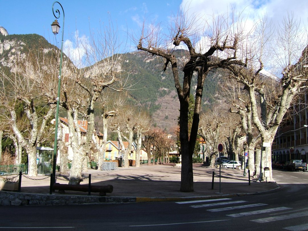
St Martin Vésubie Square
No entry
The next day a short climb out of the town got us back on the GR52a, which here follows a gently rising vehicle track following the valley of the Vésubie south, looping in and out of the gullies which cut into the steep hillside. Sunshine alternated with shade. This track ends after about 5km at a cluster of farm buildings called le Bioulet, where we expected to find signpost number 285. We continued past the buildings on a grassy path which petered out a hundred metres further on: there was no sign of a signpost. We back-tracked to the end of a drive with a no-entry sign and Sauf Ayants Droit (Except Authorised Access), and looked at the map. It showed the GR52a turning back on itself at this point and heading up the hillside through the trees, but there was no sign of a path.
If you’re reading this because you plan to follow in our footsteps, I’ve described in more detail here what happens to the path and how you can avoid wasting time first finding, then following, the wrong waymarked path. Otherwise, enough to say that an hour later, scratched by bushes and by scrambling over fallen trees, and having edged our way precariously along a narrow eroded path above a 30 metre drop, we were back at le Bioulet and setting off on the right route.
JT: Yes, what japes!
Bad weather alternative
Light rain started just as we stopped for lunch at the day’s high point, an airy ridge at 1360m altitude. As we worked our way down the steep zigzags towards Berthemont-les-Bains, thunder and lightning preceded heavier continuous rain, and by the time we reached a road it was clear it wasn’t going to stop for some time. We took it in turns for one of us to shelter under the narrow roof of an information board while the other changed into waterproofs in the telephone box alongside.
JT: Once again, the Brits abroad proving to be a class act with their phone-box changing room antics.
We debated our options. It was after 1.00, we’d lost an hour at le Bioulet, it was raining heavily, and we weren’t yet halfway through our day – there were still 11km to go, with 380m of uphill and 620m descent. The next part of the route headed up through gloomy wet forest.
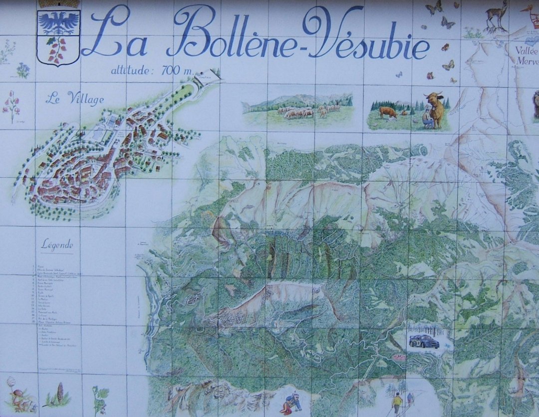
There’s not much at Berthemont-les-Bains: just the old thermal spa building, and a hotel. The spa was obviously fermé, but we thought the hotel just out of sight up the road – might be open, as we’d seen a car coming down from there. If it was open, we might be able to get a coffee, see if the rain eased off, and if not, see if they could find us a taxi to take us somewhere nearer our next overnight stop at la-Bollène-Vésubie.
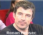
The door was open and we went in, dripping on the carpet. Two men were shaking hands: one was leaving. We asked about coffee. “Non”, was the answer. The hotel was fermé. How about a taxi? A look of complete disbelief gave us the unspoken reply – this was rural France, and there wouldn’t be even a thought of a taxi, well, anywhere. But the spoken answer was more encouraging. Where were we going? “I can give you a lift”, said the one who was leaving. He looked a bit like Ronan Pensec, a French racing cyclist of the 1980’s and 90’s.
White van down
Sitting on the floor in the back of the van I braced myself as it swung from one side to the other as Ronan negotiated a series of tight hairpin bends on the road down to the valley, at the same time lighting a cigarette and talking on his mobile phone. I had nobly offered Jonathan, with his long legs, the front seat. “You’re not worried I’ll crash?” Ronan asked as he backed to have a second try at a particularly tight bend he hadn’t quite made at the first go. “No, it’s fine”, said Jonathan, clutching the door handle but trying to appear relaxed and to follow the map to see where we were going.
JT: I was also wondering at what point I’d have to take the wheel myself … there seemed little doubt that Ronan would have a second mobile on his person that was bound to ring at an inopportune time.
Ronan didn’t know where la-Bollène-Vésubie was, but seemed happy to take us in the general direction. I was getting worried about the amount of height we were losing as we carried on downwards, and had visions of us being dropped off much nearer our destination but with 1000 metres of uphill to get there. At one point Jonathan half turned round. “I think I’ve sorted out what we can do. It’s too far to expect him to take us all the way, but I think we can manage if we can get to the turn-off just past Roquebillière.”
Ronan pulled into the side as Jonathan indicated the turn, taking three more calls on his mobile before we could finally say our thanks and goodbyes. We offerred to pay him for his trouble, but as we’d expected it was politely refused. He wished us “Bonne route”, turned the van round, and drove off back up the valley. A nice man.
Jonathan showed me the map. We’d have to do three kilometres on the road, but then we’d rejoin our old friend the GR52a for the last couple of kilometres. The amount of ascent wasn’t much, and it had stopped raining.
A grand hotel
La Bollène Vésubie
We knew what to expect, and we were right: la-Bollène-Vésubie was closed. I’d booked us a room at Le Grand Hôtel du Parc [website now defunct] but there was no sign of it (or to it) in the village centre. The only sign of life was a man sweeping the terrace of the Bar/Tabac (fermé), so I asked for directions to the hotel. He paused, then explained it was down the road “about three or four bends”. As we’d just got to the village up a steep path, the prospect of going back down didn’t thrill us, especially as we weren’t convinced we’d been well directed. We followed the road as it swung down in a series of hairpins, stopping at every bend to see if we could spot the hotel below us. After the fourth bend Jonathan took a path we had kept crossing which seemed to take a more direct route from the village. I followed the road round the bend and back. Jonathan was waiting on the road, and as I came into sight he waved and pointed. The hotel was here.
Le Grand Hôtel du Parc was a nice hotel which had seen better days. It was clean and comfortable, but looking rather run down. The large grounds – presumably the Parc – needed the attention of a gardener, or at least a lawn mower. But the welcome was friendly, we had a pleasant room, and later a good meal. We decided there was no point walking back into the village that evening.