More Valais Alps – July 2000
Introduction
A year after our first experience of alpine mountaineering (see trip report) Chris and I returned to the Valais Alps to climb some easy-ish peaks on own without a guide. Udai joined us for the first two days before leaving to join a group of Alan Kimber’s aiming to climb Mont Blanc.
When it came to writing a report of this trip I wanted to experiment with some alternatives to the standard format. In updating this website I have kept the original text, although the presenation has changed. I leave it to you to judge whether the experiment worked!
[July 2015]
Ulrichshorn
16 & 17 July
Stats: 16 July: Saas Fee – Mischabel Hut: ascent 1535m, max. altitude 3335m. 17 July: Mischabel Hut – Ulrichshorn – Saas Fee: ascent 590m, descent 2125m, max. altitude 3925m.
What’s the path up to the hut like?
Unrelentingly uphill for more than 1500 metres. Good path at first, becoming a rocky scramble from about 2600m. Upper part well (even excessively) protected with steel ropes and stanchions set in the rock. There’s even a ladder at one point.
Wasn’t there something about an old path being closed?
Absolutely right, Harry. The route marked on the Swiss maps and described in the guidebooks has been changed. The higher part of the “old” path, as it’s now known, has been officially abandoned, apparently due to a number of stonefall injuries.
At about Pt 2638 a painted sign on a large boulder directs you right, back to the ridge, rather than following the old route left. The route then stays on the ridge all the way to the hut. It’s protected with cables, iron stanchions, and a ladder – most of which were buried under snow when we were there. According to the hut guardian, by mid-July it should be a simple, scrambly, snow-free path.
We used the old route for descent, as it was still mostly under snow. But as it’s been officially abandoned, the fixed cables etc on the old route won’t be maintained or replaced so it’ll gradually become more dangerous to rely on them.
Guide-book time for the ridge route on ascent seems about the same – might be a bit slower than the old route on descent, but can’t really tell because of the conditions when we were there.
What took you so long?
The snowy conditions possibly added half an hour. Two out of the three of us were still acclimatising. One out of the three of us found the snowy, scambly part particularly hard going, and despite being urged on with helpful tips like “Haul yourself up on the cable – that’s what it’s for!”, and “Look, there’s the hut up there. It won’t get any closer if you just stand and look at it!”, took rather longer than anyone would have thought.
So why didn’t you do Nadelhorn, then?
Ah, you guessed that was the original idea!
The main reason was that two of us (one of them me) were totally knackered even by the time we got to the Windjoch. There was no way we were going to stay together and get up the Nadelhorn ridge in anything like a safe time. We discussed other options – including my offer that Chris and Udai should do Nadelhorn while I went back – but when Udai also confessed to being rather daunted by the prospect of Nadelhorn, we opted for a quick trip up Ulrichshorn and back to the hut.
And why did it take you so long to get down again?
We got back to the hut OK and had a decent rest. We asked the hut guardian about using the old route for descent, because we’d seen two people using it the day before, coming down a nice easy snowfield instead of scrambling down the ridge. He said it should be OK as there was still so much snow on the ground.
We left soon after mid-day, and were doing fine. The route goes down a series of ribs, then breaks out onto what was then a snow-field at an easy angle. The snow was deep – knee-deep in places – but without any particular problems.
The long time was entirely down to me. Just as we were getting to the end of the snow, and within sight of the original track up, my thigh muscles went on strike. The only way I can describe the problem is that I completely lost the ability to balance. Even the slightest slip threw me completely, and whatever natural agility I might have had vanished. A couple of times I stopped for a pause, and a leg just collapsed under me.
I was reduced to picking my way tentatively down even the easiest ground. Anything involving a step down was a tortuous effort, even with two trekking poles as support. I told Chris and Udai not to wait, and infinitely slowly worked my way down the never-ending zig-zags back to Saas Fee.
So there you are – that’s why it took me so long. I’ve never been in that state before, and hope never to be again. It was embarrassing and depressing. It just became very clear that the combination of lack of acclimatisation (one symptom being an upset stomach and loss of appetite, so energy levels were low too), 1500 metres uphill the day before, and the challenge of over 2000 metres down again, was too much.
Thanks to Udai for waiting at the bottom. Of course, we missed the once-an-hour bus from Saas Fee to Saas Grund by 5 minutes. And well done Chris for getting back to the apartment and getting a spare key off the landlady without a single word of any language in common!
Isn’t Ulrichshorn just a molehill among giants?
Far from it! Not only does it deservedly have its very own section in the guidebook, but the quality of the SW ridge with snow on one side and – er – snow on the other side only confirms the status of this soaring peak. Some have said that the guidebook grade of PD may be a wild undersatement. No wonder it is an ever-present challenge to all those who seek to conquer every Alpine summit over 3924 metres.
Indeed, standing by the litter bin in the top left corner of the terrace of the Ulrichsblick Hotel in Saas Fee, the visitor can see how Ulrichshorn alone dominates the skyline above the village. Other hotels may have their Allalinhorn or Alphubel views, but the true majesty of Ulrichshorn can best be appreciated from this idyllic viewpoint.
Few tales survive of man’s epic struggles on this mountaineer’s mountain. Mention Ulrichshorn in the bars of Saas Fee – or even as far afield as Saas Almagell – and a hush falls over the room. Local guides rarely venture onto Ulrichshorn’s slopes, and those that do say little about their experiences. Climb Ulrichshorn and the mountain will earn your respect, but most choose to keep this intensely personal experience to themselves, content with memories that few will ever share.
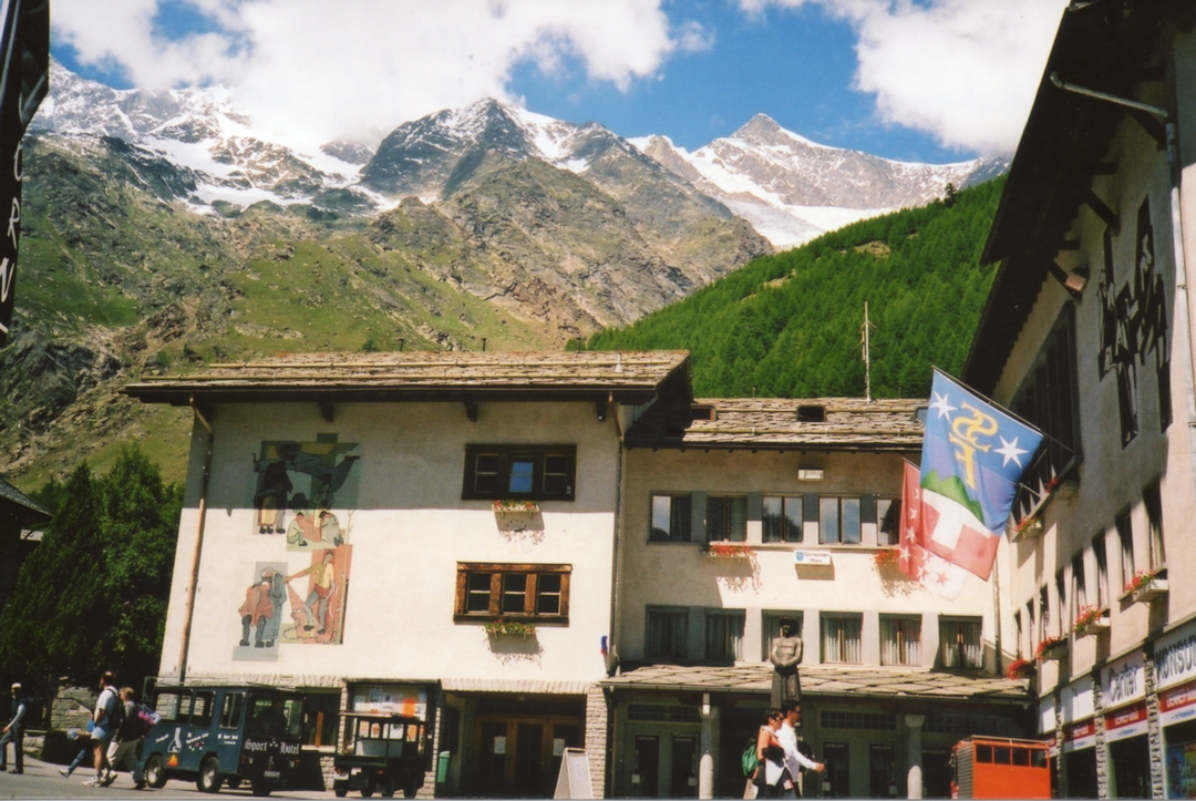
Ulrichshorn From Saas Fee
Allalinhorn
19 & 20 July
Stats: 19 July: Plattjen – Britannia Hut: ascent 460m, max. altitude 3030m. 20 July: Britannia Hut – Allalinhorn – Mittelallalin (Metro): ascent 1077m, descent 573m, max. altitude 4027m.
Allalinhorn, or The Hohlaubgrat Harriers
A play in one act.
Scene 1 – The common room in the Britannia Hut, 4.00 am.
In the dim light we see Chris sitting at a table, spreading processed cheese onto a thick slice of stale brown bread. Tony enters and sits down opposite him. They do not speak. Tony spreads red jam onto a slice of bread. They eat. Tony pours a pale brown liquid from a metal jug into a cup. As he pours, a sodden tea-bag falls out of the jug into his cup. Tea splashes out onto the table. Tony drops a sugar cube into his cup and stirs it with a plastic stick.
They finish the bread. Chris eats the rest of his jam with his tea stirrer. They get up from the table and exit. It is 4.07 am.
Scene 2 – A glacier, 80 metres lower than the hut, 4.30 am.
Chris, with a rope tied to his harness and wearing crampons, shines his head-torch on Tony’s feet as Tony tries for the third time to secure the strap on his left crampon. He finally succeeds. Taking the free end of the rope he ties a knot and attaches it to his harness. He tugs. It holds.
Meanwhile, Chris has deftly wound a dozen coils of rope round his body and tied them to his harness with a neat knot. Tony starts to do the same, but gets in a tangle by switching the direction of the loops mid-way through the process. The coils straggle untidily around his chest, but he ties a knot round them anyway and attaches them to his harness. Chris gives him a long look and speaks for the first time.
Chris: Bit of a wally this morning, aren’t we?
Scene 3 – Higher up the same glacier, half an hour later
Tony and Chris move slowly up the glacier, a rope between them. Tony is in front. To their left the moon, three or four days off full, hangs in a clear, dark sky. Its light catches the slopes of the glacier, which shine in a broad band of silver. The sky is full of stars. Mountains rise all around them. They keep moving.
On a back-projection screen at the back of the stage we see the view down the glacier. Several strings of black dots, some with lights, are following in their tracks.
As we watch, three young mountaineers, closely roped together, enter left behind Chris. They rapidly overhaul Chris and Tony, who keep walking slowly onwards. No-one speaks as they pass. The three move on and exit right. Chris speaks.
Chris: Those were those Germans.
Tony: Yes.
Scene 4 – A 30-metre rock step not far below the summit of Allalinhorn, 8.35am.
It is full daylight. The sun is shining. Tony is standing sideways with one foot above the other on a narrow ramp of snow at the base of a shallow and easy-angled gully. A sling clipped to a metal ring provides some protection against a slip. The rope passes through his belay plate and disappears up the gully and out of sight.
The minutes tick by. Occasionally the rope moves, and Tony pays another metre or two through his belay plate. Now and again chunks of ice the size of apples rain down from above. After five minutes or so all movement stops.
Tony stands and waits. Four Spaniards arrive and stand a few metres below him. More time passes.
Tony (shouts): Chris!? (no answer. He shouts again) Chris!? (still no answer).
1st. Spaniard: ¿Qué pasa?
Tony: J’n’sais pas. Rien.
Ten metres of rope drop down the gully and end in a tangle at Tony’s feet. He feeds the loose rope back through his belay plate until the rope is nearly tight again.
Tony (shouts): Chris!? (no answer)
He looks at the Spaniards and shrugs. Two more climbers arrive and join the queue below.
More minutes pass. It is now 8.50am.
Suddenly the rope starts moving again, at first slowly and jerkily, then quickly and firmly as all the slack is pulled in. When the rope is taut Tony tugs it three times, removes it from his belay plate, unhooks the sling from the metal ring, and starts to climb into the sloping gully. He turns to wave to the Spaniards, and disappears left round a corner.
With the stage lights off, the back-projection screen shows a sequence of faded black and white still images of early alpine exploits – sheer rock faces, crevasses, men in tweeds with long alpenstocks and nailed boots, women in long skirts crossing glaciers, etc. The images fade as the lights come up to show …
Tony, on a 35 degree snow slope with Chris some 10 metres above him crouched over his ice-axe pushed shaft-down into the snow. The rope goes round the head of the axe in an imitation of a belay. Tony climbs up to Chris.
Tony: What happened?
Chris: Keep moving.
They pick up the rope in loose coils and set off.
Tony and Chris walk the last few level metres to the summit – a low pile of rocks and stones surmounted by a plain iron cross. Two other small groups are there too. Tony and Chris each touch the summit rocks, and shake hands.
Tony: Well done! Our first unguided 4000-er.
Chris: And first AD.
Tony: In guidebook time, too.
They turn and walk about 25 metres back along the small summit ridge to a low rocky outcrop where they take off the rope and their rucksacs. They each open their rucksac and take out some food, which they eat slowly while they watch a party of six or seven people, led by a guide with a UIAGM badge, reach the summit ridge from the opposite direction. The group goes to the summit, each touches the rocks or the cross, and they return to near Tony and Chris. The guide takes a bottle of schnapps and several glasses from his rucksac, and pours a shot for each client. They drink. Tony and Chris look on hopefully, but are disappointed. Tony takes a photo of Chris, and vice versa.
Tony nods in the direction from which the other party had come.
Tony: Normal route. Must be our way down.
Chris: Yes.
Tony: What happened back there on the rock step? What took you so long?
Chris: I don’t want to talk about it. I made a complete hash of it. Did you find a crab I dropped?
Tony: No.
Chris: Better be off, then.
Tony: No sign of those Spaniards yet.
Chris: No. Wonder if they found my crab.
They rope up, and disappear out of sight below the summit ridge.
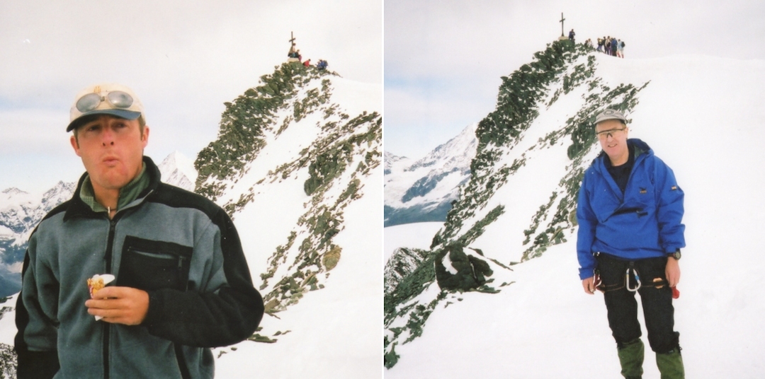
Allalinhorn Summit
Weissmies
21 & 22 July
Stats: 21 July: Saas Almagell – Almageller Hut: ascent 1214m, max. altitude 2894m. 22 July: Almageller Hut – Weissmies – Hohsaas: ascent 1129m, descent 992m, max. altitude 4023m.
My second attempt at this mountain, but Chris’s first. See last year’s report for a description of the route, and the events leading to my turning back before the summit.
This time we were successful. The conditions were good, and we made good time to the col, up the snowfield and onto the ridge. We climbed the ridge unroped and without crampons. This year I had an altimeter, so I was able to check the height of the point I reached last year (there was a fixed post where I turned back) – it was 3835 metres.
Chris reached the top of the ridge and the fore-summit a few minutes before me – I was going a little slower and like a true English gentleman gave way to two or three roped parties who were moving faster than me. We put crampons back on, and nonchalantly continued unroped to the main summit.
It was quite busy on the summit. After the usual congratulations and refreshments we set off (roped) down the normal ascent route of the NW flank. This is a glacier route, steep in parts, and passing through some severely crevassed sections. The route was well-trodden, though, and we passed several parties making their way up. We made it to Hohsaas without any problems, and took the cable back down to Saas Fee.