South West Coast Path – Day 41
Plymouth: Cremyll Ferry – Mount Batten
21 April 2026
Distance on Coast Path: 14.2km; ascent: 104m
Total distance: 17.6km; ascent: 104m
Walking time: 4h 03′
Total time: 5h 12′
Overnight: Self-catering, Plymouth
It seemed to me that the section of the Coast Path which twists its way along the waterfront through urban Plymouth deserved to be treated differently, so I organised a short visit to complete this and the next section over a couple of days. Thus I set off from my one-room self-catering apartment near Plymouth Hoe carrying a very light rucksack and wearing trainers instead of boots, to walk to the slip where the ferry from Cremyll had dropped me back in October last year.
A little over five hours later, almost at my walk’s end at Mount Batten, my head was full of the contrasts I’d seen, my phone’s photo gallery showing a screenful of pictures I’d taken.
When I finally sat down to write an account of the day I didn’t know how best to do it. To describe everything would need a whole booklet. In fact someone has done just that, and I recommend that anyone who wants to follow the Coast Path through Plymouth should visit the Tourist Office at Sutton Harbour (near the Mayflower Steps) and pick up a free copy of ‘Plymouth’s Waterfront Walkway’, a thirty-page booklet with detailed information on the many interesting things along the way. You can also download it from the link above, but it’s good to have the paper version with you as you go. I wish I’d had it with me on my own walk, but I only found it afterwards! So what follows is a string of impressions in truncated note form of what I came across on the way.
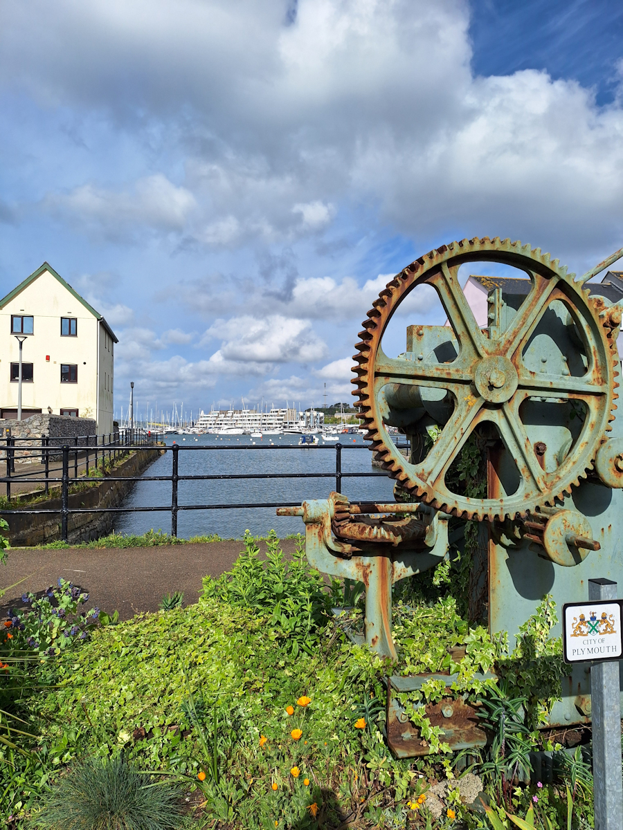
Admiral’s Hard. That’s what the slipway for the ferry is called. Down Cremyll Street – glimpses of the water – a relic of old machinery. Ducking down a side entrance for a view of Royal William Yard. Past a pub called “The V O T” which turns out to be “The Victualling Office Tavern”, a clue to what’s to come. Decrepit garages and storerooms fronting directly onto the street. The dilapidated and faded rear entrance to the Durnford Hotel – is it still operating?
Old and new
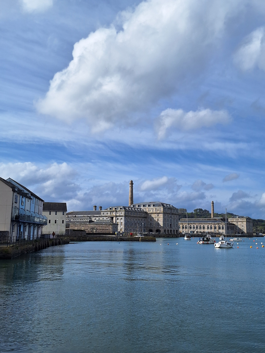
Royal William Yard
Through the entrance gate to Royal William Yard. This place is huge! I hadn’t imagined it like this. Solid stone buildings, tall chimneys, fading lettering above doorways. “Bakery”. “Cooperage”. This is how the Royal Navy was kept supplied with food and drink (‘victualled’) in Victorian times. A massive operation. Some buildings converted to fashionable waterside apartments. Evidence of attempts to attract commercial trade – Nando’s, Wagamama – but I’m not convinced.
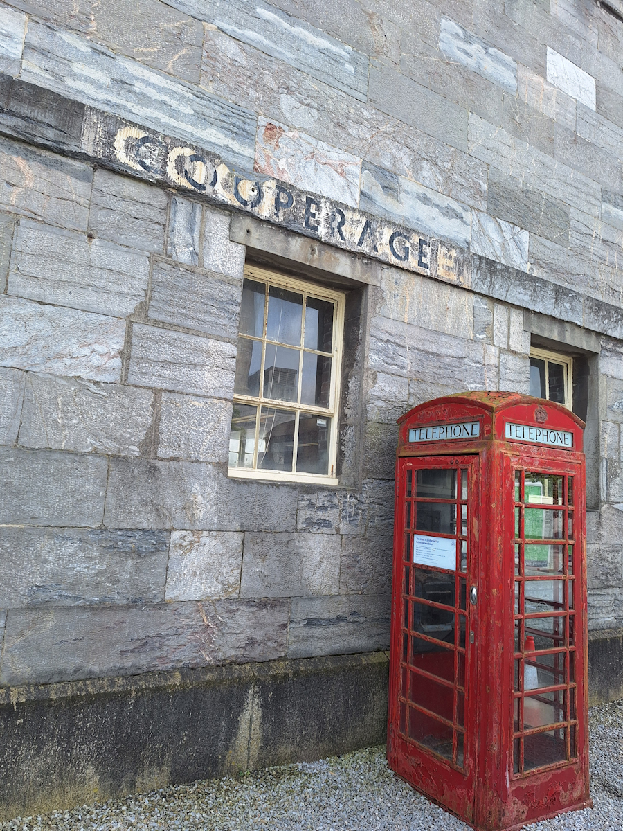
Cooperage
By a door under an archway, a wooden post with a yellow top and an SWCP waycorn. The headquarters of the SWCP Association. They seem surprised when I walk in to say ‘Hello’. They’ve only just moved in so haven’t got used to drop-in visitors yet. I leave the Yard by the four flights of new stairs cantilevered onto the Yard’s defensive wall.
Through a small park and into Durnford Street which has fine Victorian houses painted in Wedgwood colours, and quotations from Arthur Conan Doyle cast in iron and set into the pavement. At the far end the road is closed even to walkers. The diversion takes me down Stonehouse Street, all single-storey sheds: tool hire, car body shops, car spares, tyres new and part-worn, MoT While-U-Wait, garage door installation. Incongruously, Devon Hair & Beauty Supplies.
Back on the official route looking down at the Brittany Ferries terminal then following the promenades and road beneath West Hoe and The Hoe itself, past the closed and deserted art deco Tinside Lido and the Royal Citadel for a coffee stop close to the Mount Batten ferry pier.
The Barbican and Sutton Harbour, Plymouth’s original harbour. American tourists disappointed with the very low-key Mayflower Steps – pavement plaque, small arch, two flagpoles with Union and US flags.
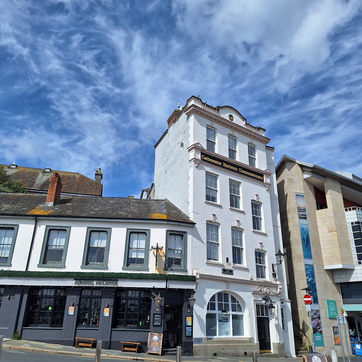
By Sutton Harbour
Over Sutton Harbour’s lock gates to the National Marine Aquarium. Built in the late 1990s to an unremarkable design on a rather cramped site. Paid entry, so I just look round the shop and find only tourist tat.
A transition point. No more tourists and coach parties but a succession of once-separate localities. Low functional buildings and houses from Victorian times and earlier mixed with modern heavy industry. Breakwater Hill – an old road now blocked to traffic leads from Coxside to Cattedown, emerging at a huge waste processing plant served by big tipper lorries. The road is covered in dust, the pavement blocked or non-existent. A very large ship is being loaded with scrap. Bricked up old warehouses and the backs of newer corrugated buildings. At the end, The Passage House pub looks out of place and not very inviting, though it is open. More car workshops. “Quality Used Cars”.
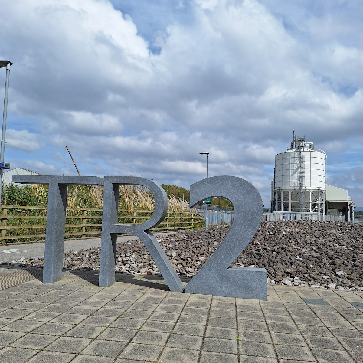
Coast Path at T R 2
A little further, a modern building which looks like the headquarters of a medium-sized accountancy firm has “T R 2” in solid stone sculpted outside. I later learn it’s the Production and Learning Centre of Plymouth’s Theatre Royal. It’s next to a cement works and opposite the storage tanks of a bulk fuel depot. Past a large scrap metal dealers – “Trade and Public Welcome”, “Cars Motorbikes Small Vans” – I follow a pavement alongside a busy road to traffic lights at the junction with the A379. Turning right the Laira Bridge takes me across the River Plym, here known as Cattewater. Over the bridge another vast shed: “Bridgestone Exhausts Tyres Batteries”.
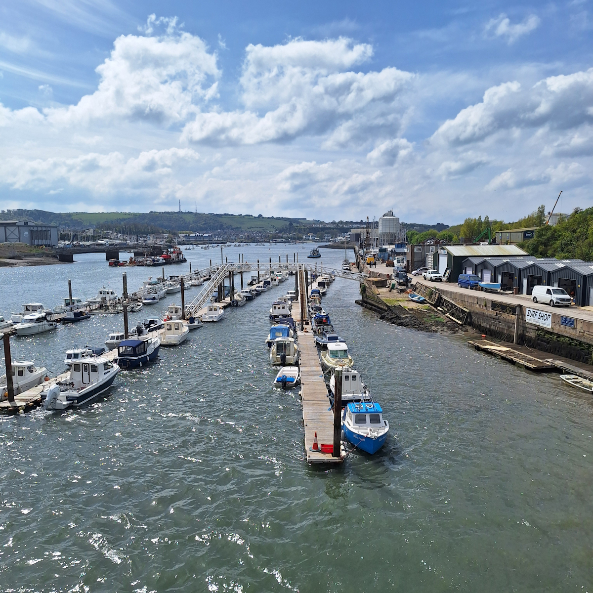
Crossing the River Plym (Cattewater)
Still on the main road, another dusty and forlorn pub, The Morley Arms. A petrol station. A modern glass-fronted showroom “Plymouth Marine” sells shiny expensive-looking jet-skis and outboard motors. On the other side of the road is a retail park, “Sugar Mill”. I’m now in Oreston, the next old locality. Still on the main road a long breeze-block wall about head-height and with rough, stained grey rendering separates the road from a straight creek with moored boats – Pomphlett Lake. A series of poems with the words cut out of iron strips is fixed to the wall: one laments the wall separating it and the reader from the water beyond.
Turning right across the end of the creek and passing a stone rhinoceros standing in long grass by the side of the path, I turn right again to follow the opposite side of the creek. I can see now that as well as the moored boats Pomphlett Lake is also a boat graveyard. The derelict hulks are not the last ones I’ll see on this visit.

Derelict Hulk
I follow the Coast Path through Oreston, Hooe and Turnchapel, now merged together but each still separately identifiable with its old fishermans’ cottages and one or more pubs. I feel I’m following half-forgotten paths which once ran along quaysides but are now cut off from the water by security fencing and razor wire to protect the expensive yachts in the yards behind. There’s new building too, almost exclusively modern waterside apartments, not ugly or oppressive, just bland: the kind you would see in stock photos in Getty Images.
Finally I approach Mount Batten peninsula. There’s a lot of construction going on here and it’s not obvious where the Path goes. I adopt my most confident demeanour and walk through the expensive boatyards. One, Plymouth Yacht Haven, is an aircraft hangar-sized shed with an open front revealing several large and expensive yachts jacked up undercover like a millionaire’s version of a Kwik-Fit tyre and brake shop.
The jetty for the ferry back to Sutton Harbour is fenced off but the temporary alternative is only another 100 metres along the peninsula. I have time in hand so I walk past the Hotel Mountbatten to the end, then along the wide breakwater which runs about 300 metres out to a small observation tower. The strong wind which has been blowing all day carries me along but I have to fight it on the way back.*
The ferry journey back to Sutton Harbour and The Barbican takes about ten minutes. The small boat weaves a course through moored boats of all types and sizes and past a commercial bunkerage depot which displays the price of marine diesel in the same way as your local petrol station advertises unleaded petrol.
In conclusion, an interesting day and very different from any other day on the Coast Path, varying from the historic to the derelict via the industrial. Notably there has been nothing newly built of any interest. The centre of Plymouth is undergoing a major reconfiguration and redevelopment but none of that reaches the waterfront.
* Mount Batten has an interesting history including its time as RAF Mount Batten and its association with T.E.Lawrence (‘of Arabia’). The ‘Plymouth’s Waterfront Walkway’ booklet has a section about it, and Wikipedia has an article with links to more details.
Comments
South West Coast Path – Day 41 — No Comments
HTML tags allowed in your comment: <a href="" title=""> <abbr title=""> <acronym title=""> <b> <blockquote cite=""> <cite> <code> <del datetime=""> <em> <i> <q cite=""> <s> <strike> <strong>