Channel 2 Channel – Day 3
Langport to Bridgwater
16 July 2021
Distance recorded: 21.1km
I read overnight that the River Parrett is tidal as far as Langport, and sure enough as I rejoined it shortly after leaving the town the water level was a little lower, exposing silt-covered reeds and grasses on the banks of the river channel.
The river meanders vaguely westwards then north-west, though its twists and turns took me through most points of the compass. I passed the sluice where the Sowy River splits away; an artificial flood relief river which eventually joins the King’s Sedgemoor Drain. This Drain is large and important enough to have its own sign on the M5 where the two cross.
I was within a couple of kilometres of Burrowbridge, where I was planning a midday break, when I was startled to see what I first thought was Glastonbury Tor in the distance. After a moment’s thought I realised it couldn’t be; it was Glastonbury’s little brother, the delightfully-named Burrow Mump. It’s owned by the National Trust.
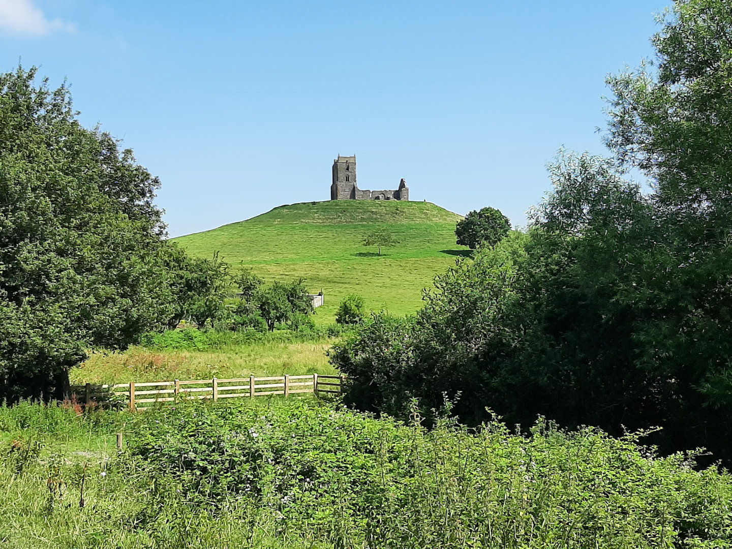
Burrow Mump
I was aiming for the pub in Burrowbridge, the King Alfred, visited and recommended by social media friend @silkskt who had stopped there on her recent walk from John O’Groats to Land’s End. I arrived half an hour before it opened, but gratefully sat at one of their outdoor benches in the shade until it turned 12 o’clock and I could order a ginger beer.
Setting off a little later and back alongside the river I decided to stop for lunch at the next shady place I came to. That turned out to be twenty minutes further. A feature of this open landscape with its sparse tree cover is that there are no fallen trees or logs to sit on; the choice is either to sit on the ground or stay on your feet. In what little shade there is the ground is mostly overgrown with nettles and other spiky things, so I stood. When I was leaving Langport the convenience store had not yet had its delivery of sandwiches, but I’d bought a freshly prepared bacon sandwich, unseen in its brown paper bag, from an ‘artisan bakery’. This turned out to be a generous portion of bacon between two thick, heavy slices of sourdough rye bread – far too dry for walkers’ fare in the hot sunshine. A good half of the bread went into the undergrowth.
A bit further along I passed Westonzoyland Pumping Station – now a museum – on the far bank. It dates from the days when all the drainage works in the area were steam-powered.
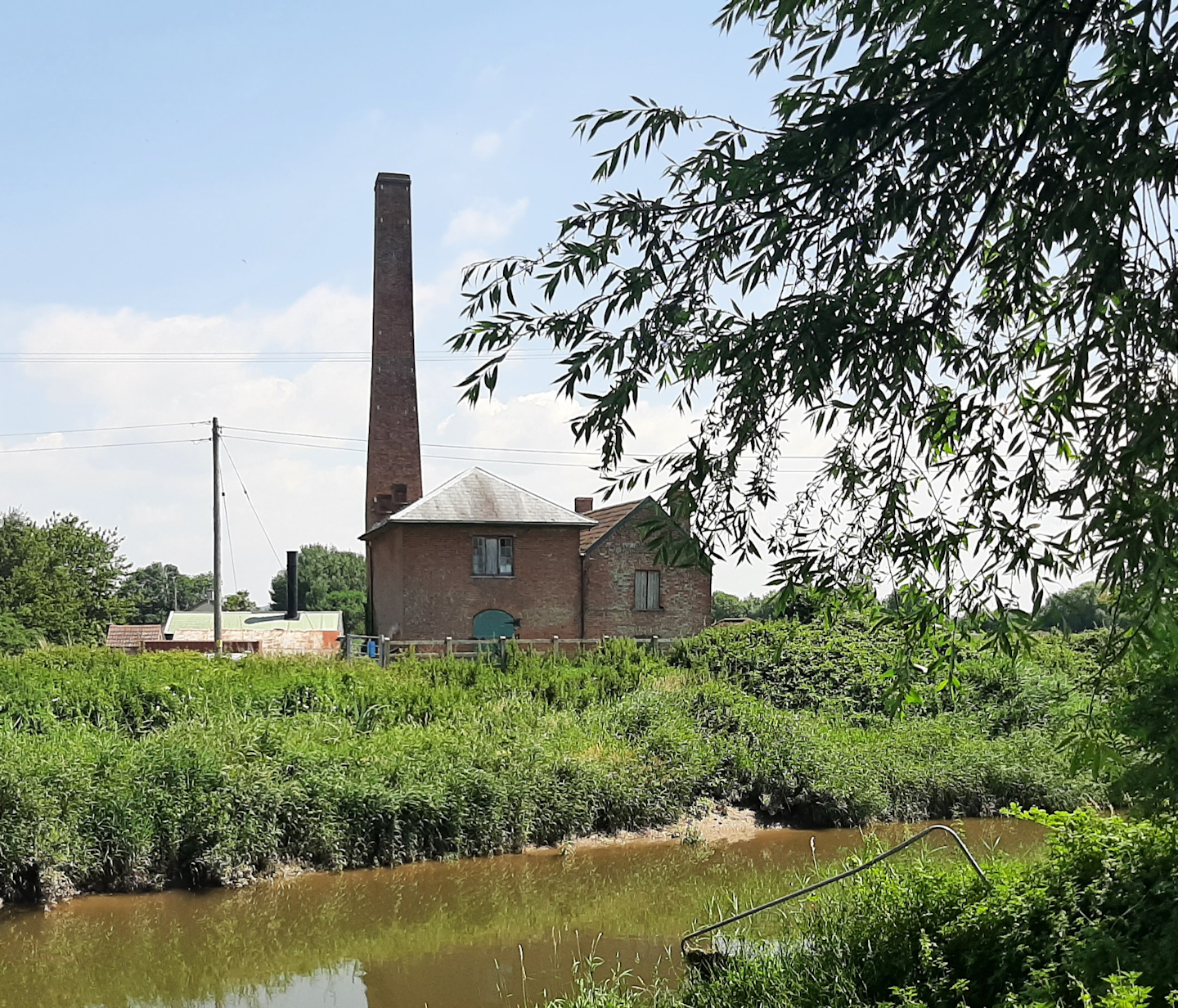
Westonzoyland pumping station
By now my dislike of long grass, mown and unmown, had grown into a deep hatred so it was a relief when the River Parrett Trail left the river and headed south-west on a lane to meet up with the Bridgwater and Taunton Canal. The towpath has been upgraded to a national cycle route, so I relished walking on smooth gravel and making good time as far as the outskirts of Bridgwater.
The canal was built to link Somerset’s two major rivers, the Tone (as in Taunton) and the Parrett. I was puzzled to pass several pill box fortifications along the way, obviously dating from WW2.
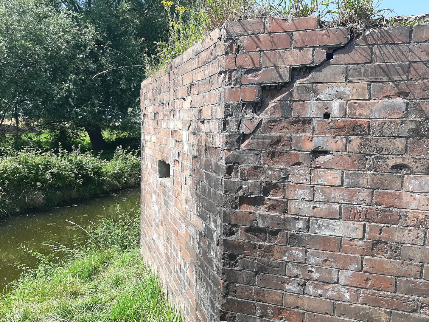
WW2 pill-box
In my Bridgwater B&B I did a quick internet search and found they were part of the Taunton Stop Line, one of several Stop Lines built during the war as defences against a possible invading army.
Later, I went for an after-dinner stroll and found the Parrett again. Now very much tidal, the water level had dropped right down to expose wide and rather evil-looking mud banks on either side.
Comments
Channel 2 Channel – Day 3 — No Comments
HTML tags allowed in your comment: <a href="" title=""> <abbr title=""> <acronym title=""> <b> <blockquote cite=""> <cite> <code> <del datetime=""> <em> <i> <q cite=""> <s> <strike> <strong>