
South West Coast Path – Day 32
Lizard Point – Coverack
10 June 2025
Distance on Coast Path: 16.4km; ascent: 330m
Total distance: 17.4km; ascent: 330m
Walking time: 4h 31′
Total time: 6h 05′
Overnight: Self-catering, Helston
Logistics: To start: 34 bus Helston – Lizard. Finish: Taxi Coverack – Helston
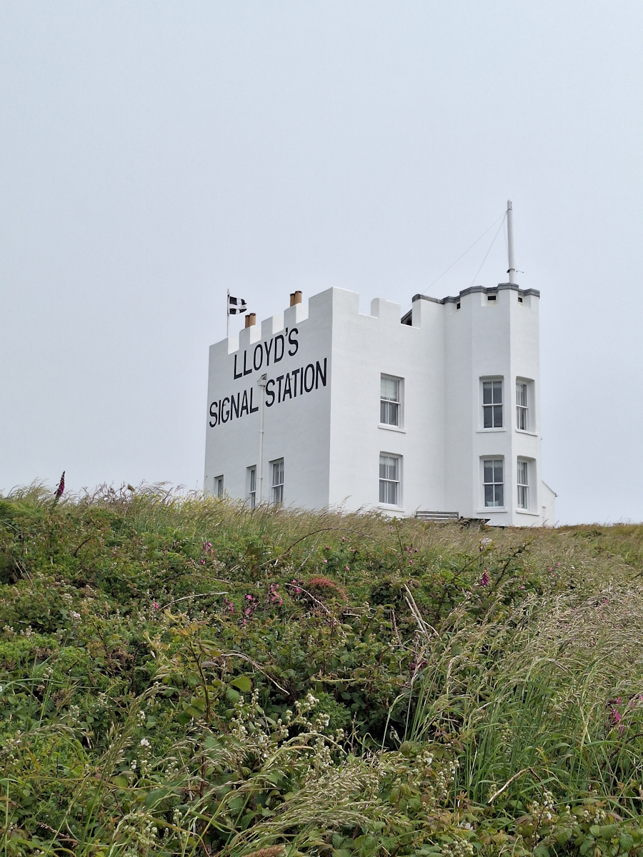
Lloyd’s Signal Station
After buying a hot pasty for lunch at the pasty shop opposite the bus stop in Lizard village I retraced yesterday’s path to rejoin the Coast Path just below the Housel Bay Hotel. Once clear of the hotel grounds a bright white building with decorative battlements comes into view. It has “LLOYD’S SIGNAL STATION” painted in large black letters on the side. On the far side a modern addition seems to show that it’s now a private house.
Just a little further at Bass Point is another Lookout Point staffed by the Coastwatch volunteers I first came across in May last year on the way out of Boscastle. It was the first Coastwatch station in the country to be opened. The man on duty greeted me from the first floor observation window and we chatted for several minutes before I moved on.
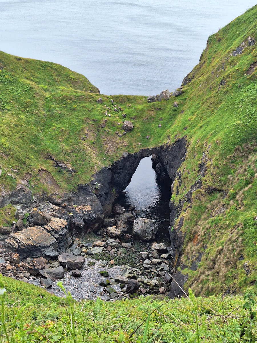
The (alleged) Devil’s Frying Pan
From here onwards the Path winds and twists along the cliffs with drops into several coves; here on the sheltered side of the Lizard peninsula it was mostly badly overgrown. Just before the fishing hamlet of Cadgwith is another collapsed cave; this one with the unlikely name of “The Devil’s Frying Pan”. I say ‘unlikely’ because I just don’t believe local people ever referred to such features in this way; the names seem to me more like invented myths.
Coming into the Cadgwith the Path follows a delightful route through the gardens of houses on the slopes above the harbour which at this time of year were in full and colourful bloom. I was charmed by the little place – still a working fishing cove, even having its own shop selling fish, shellfish, crab and lobster. I was very tempted by the crab sandwiches, but the still-warm pasty I was carrying on the outside of my rucksack to avoid it melting the chocolate bar I had in reserve would have been wasted.
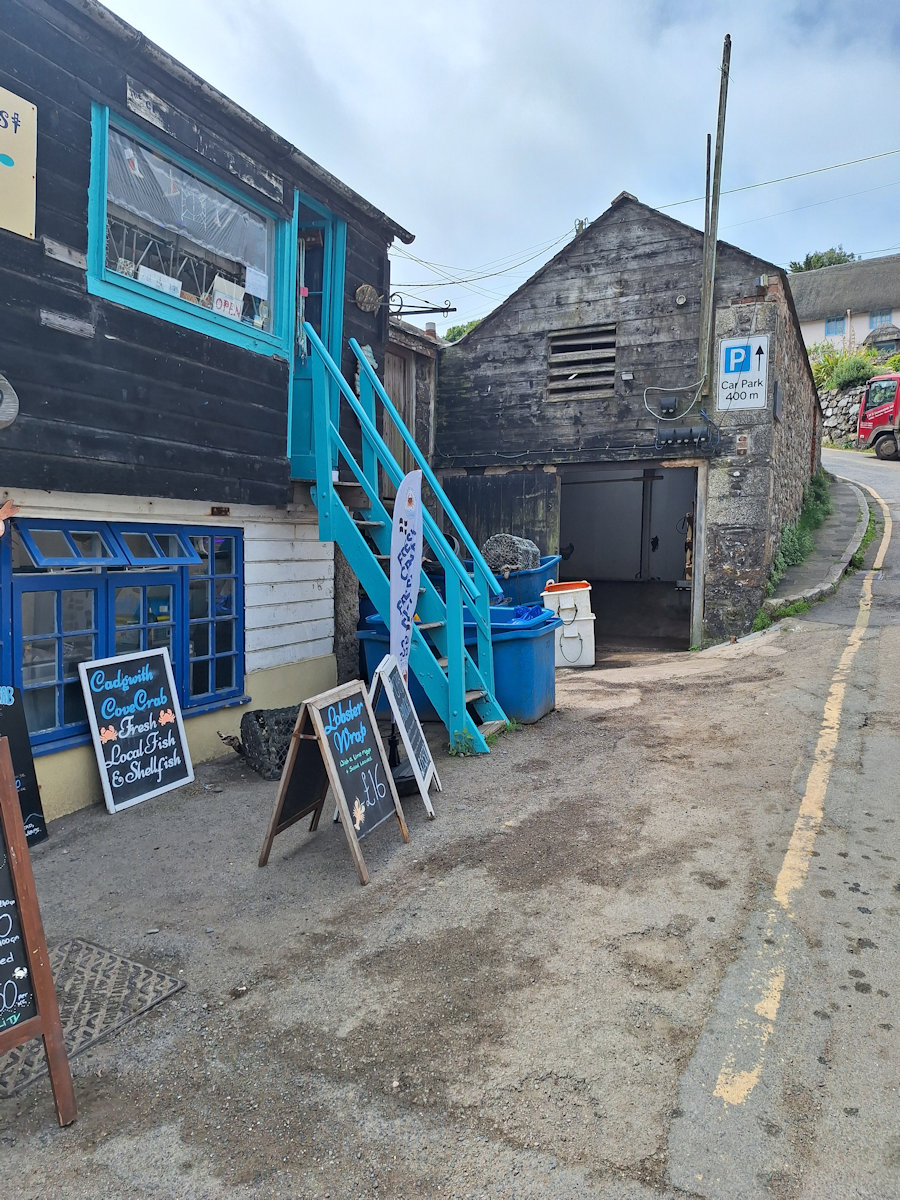
Lobster Wraps!
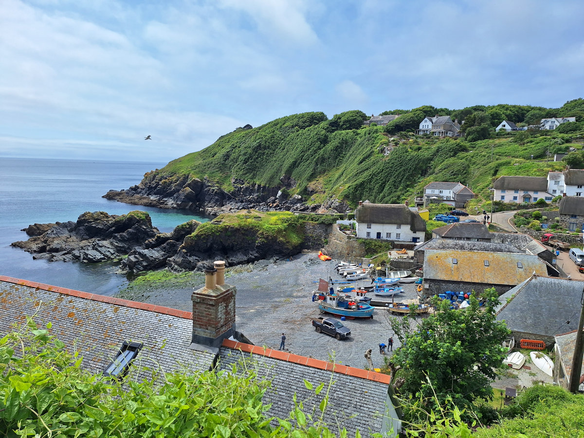
Cadgwith Cove
The rest of the day was much like the first part – overgrown paths, occasional woodland, gradually getting more stony underfoot making progress even slower. I realised I had no chance of reaching Coverack in time to catch the only bus of the afternoon but was happy enough knowing I could get a taxi back to Helston. It stayed mostly sunny and dry apart from a little drizzle along the way just before Kennack Sands where I stopped for lunch. The steep valley at Downas Cove had one of the Coast Path’s dreaded staircases on the far side which was particularly challenging quite late in the day.
Just before Coverack is a section – Chynhalls Cliff – of which the guidebook says the Path
goes amongst the natural rock outcrops which can be slippery in wet weather being continually rocky, steep and with significant steps and abrupt changes in level. A difficult section in fine weather and much worse in wet wintry weather.
Good news! You can avoid all this by staying above the cliff and following a level footpath to a point just above Coverack where it rejoins the Coast Path. I was tired by now, so it was an easy choice.
Coverack has one major fault: the only pub is by the harbour as you enter the village from the Path. The bus stop and car park are at the far end over half a kilometre away. By the time I’d realised this I had reached the car park/bus stop and the thought of trudging back and then back again was too much. But I had a phone signal so I called for a taxi* and settled down for what turned out to be only about half an hour’s wait.
* Taxi service: Telstar Taxis (based at Goonhilly Downs) 01326 221007
Comments
South West Coast Path – Day 32 — No Comments
HTML tags allowed in your comment: <a href="" title=""> <abbr title=""> <acronym title=""> <b> <blockquote cite=""> <cite> <code> <del datetime=""> <em> <i> <q cite=""> <s> <strike> <strong>