
South West Coast Path – Day 31
Poldhu Cove – Lizard Point
9 June 2025
Distance on Coast Path: 15.7km; ascent: 362m
Total distance: 16.7km; ascent: 412m
Walking time: 4h 18′
Total time: 5h 21′
Overnight: Self-catering, Helston
Logistics: To start: 34 bus Helston – Poldhu Cove. Finish: 34 bus Lizard – Helston
An unassuming moss-covered granite column on Poldhu Point to the south of Poldhu Cove is all that remains to mark the site of Guglielmo Marconi’s radio station from where he successfully transmitted the first transatlantic radio signal in 1901. The Path carefully avoids the grounds of a large white building, originally a hotel and now a care home. A little further is a more modern wooden hut which is the home of the Marconi Centre, owned by the National Trust and open during the summer months on Wednesday and Sunday afternoons. It’s run by volunteers from the local amateur radio club. Passing by on a Monday morning it was deserted and the gates were locked.
From Poldhu it’s only a short walk to Mullion Cove. Mullion itself is a small town about 2km inland to the north-east; given the size of the town I was surprised the Cove was just a pair of stone and concrete jetties forming a small harbour with no boats.
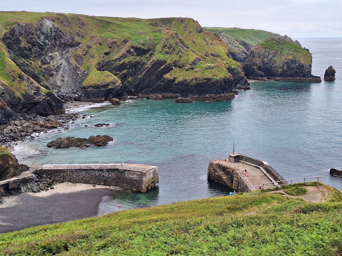
Mullion Cove
From Mullion Cove onwards the Path is easy going, passing through the separate sections of The Lizard National Nature Reserve. Much of the route is level and open through a landscape on the borderline between heath and moorland. Placid cattle and a small herd of ponies were no hazard, to the relief of two young women walkers I had seen ahead of me for several miles but who had slowed so I could catch up as they were understandably nervous about the first herd of cows (actually young bulls!). The cattle hardly bothered to look as we passed by.
The SWCP guidebook rates Kynance Cove as the highlight of the section (if you don’t count Lizard Point, I suppose). It has a car park and a café, and reaching it around lunchtime on a sunny day it was busy! But the cove with its jumbled rocky outcrops with little beaches between them is certainly very attractive. I found a spot for my own lunch on the hillside on the far side
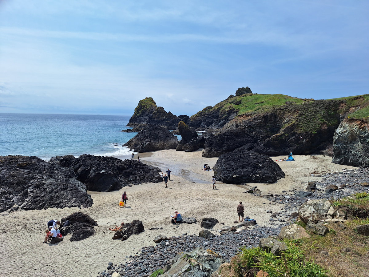
Kynance Cove
As a sidenote I should mention a slight navigational misjudgement. Approaching the cove the Path goes across a wide flat open field with no obvious defined route. Leaving it slightly too long to turn down the descent to the cove I found myself at the top of a very steep, very narrow stony gully no more than a metre wide. There was definitely a path continuing at the bottom so I gingerly negotiated it, then followed the stony path below which shortly led me out onto the easy open green slope I should have been coming down the whole way.
It’s only about 3km from Kynance Cove to Lizard Point. Both have car parks and the path between is easy so not surprisingly there was a fair number of people going in both directions. Old Lizard Point looks to be further south than the approved Lizard Point a short distance away, but looking at the map the rocks below the official southernmost point of the English mainland do extend further. There is a small gift shop, two cafés, a National Trust shack and toilets. The self-proclaimed “Most Southerly Café” was closed but the other was busy. Unlike Land’s End there’s no iconic photo spot other than to stand on the cliff edge.
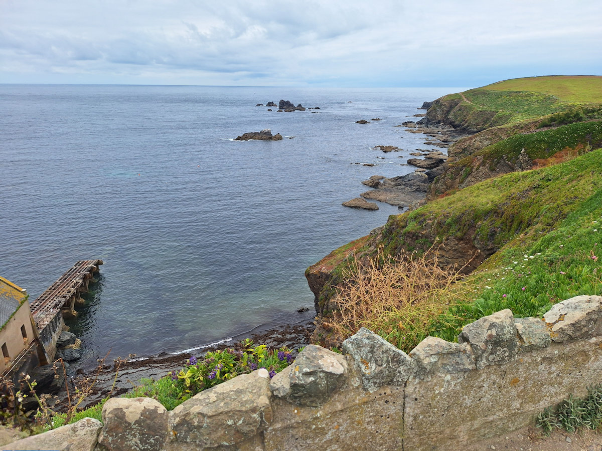
Looking back (west) from Lizard Point (Spain off to the left)
Rather than walking straight up the road into Lizard for my bus I carried on below the lighthouse and round to the next bay – Housel Bay – where a footpath leaves the Coast Path just before the Housel Bay Hotel to follow a track which joins the road just short of the village. With just ten minutes before my bus was due the day’s timing had worked out well.
Comments
South West Coast Path – Day 31 — No Comments
HTML tags allowed in your comment: <a href="" title=""> <abbr title=""> <acronym title=""> <b> <blockquote cite=""> <cite> <code> <del datetime=""> <em> <i> <q cite=""> <s> <strike> <strong>