
South West Coast Path – Day 21
Portreath to Lelant
12 May 2024
Distance on Coast Path: 21.3km; ascent: 162m
Total distance: 21.6km; ascent: 186m
Walking time: 4h 57′
Total time: 6h 28′
Overnight: The Nook, St Ives
Sunday morning bus times weren’t helpful for getting back to Portreath so I booked a taxi from the hotel which dropped me off at the harbour car park at 9.20.
The question for today was “Will I make it to St Ives?” I’d booked two nights in the town so Monday would be a rest day; an opportunity to explore the town more than I’d done on previous short visits and to visit the Tate gallery which had been closed the last two times I’d tried to go. The SWCP guide book splits Portreath – St Ives at Hayle, but I thought I had a good chance of walking the extra (level) 10km to St Ives. My insurance policy was that there’s a bus service between Hayle and St Ives. There’s even a train – Hayle is on the main line to Penzance; the next station only two or three miles away is St Erth from where a branch line train shuttles back and forth to St Ives. So Hayle was my first objective.
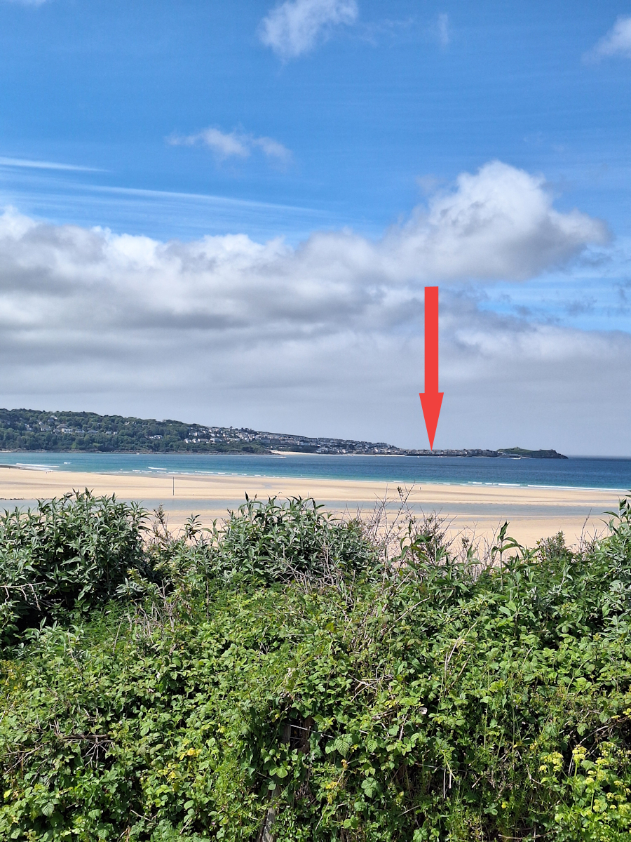
Distant St Ives.
After the early morning mist cleared it was another bright and sunny day, and was to be another day dominated by Big Sand. A feature of the route took my mind back to the day I walked from Westward Ho! to Clovelly – for most of the way the end of the walk was visible across the wide bay. I could see it, but it would take a long time to get there!
Leaving Portreath there were two relatively minor valleys to cross before I came to the longest, flattest stretch of the whole Coast Path so far! For almost three kilometres the path was a wide and level gravel track along Reskajeage Downs. Even when this ended the path dropped a little then carried on almost level for another three kilometres before finally dropping down to sea level after Godrevy Point.
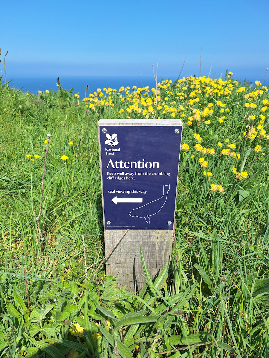
Seal watching this way
Being Sunday it wasn’t surprising that there were plenty of people around, the easy level surface attracting cyclists as well as walkers. The cyclists ranged from hard-core mountain bikers to families out for a leisurely ride. Approaching Godrevy Point and car park there were National Trust signs announcing a seal viewing point. There was quite a crowd on the cliff above a small cove, but if there were seals on the rocks below they were too well camouflaged for me to see them.
Past the car park the Path crossed the rather undistinguished Red River on a footbridge but then pathfinding became difficult. There’s a level area which is an abandoned quarry and there were many tracks. The guidebook says “Follow the large slate waymarks through the former quarry …. keep ahead through the dunes, following the signposts.” I only saw one large slate waymark, and it wasn’t obvious which direction it indicated. I didn’t see any signposts. I ended up in the dunes above the beach, at first following footprints in the dry sand but quickly becoming caught in the profusion of narrow trails between the dune grasses. I decided to get onto the beach but the low cliff looked too steep and unstable to try a direct route.
Continuing to force my way through the dunes I noticed two women a little distance behind me, each with a small dog. Eventually there was a break in the cliff and a sandy way down to the beach. A man came up towards me. “Thank you, Sherpa!”, he called as he got closer. “My wife and her friend have been following you as they lost the path and you seemed to know where you were going.”
So I came to walk Hayle Beach. From the point where I joined it to its end at the approach to Hayle is about 3km, about the same as Perranporth a few days before. It’s another kilometre if you include the stretch I walked in the dunes from the old quarry. Like Perranporth the distant end never seemed to get any closer.
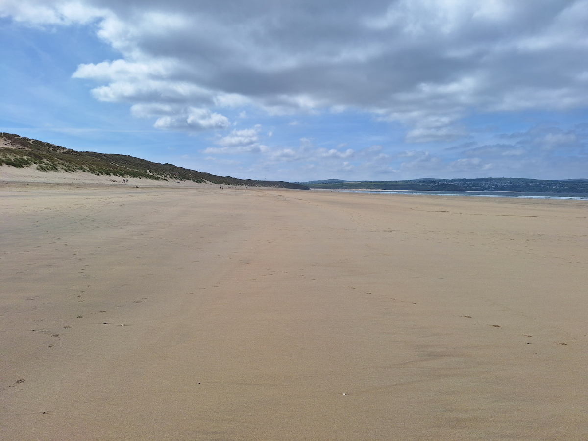
Hayle beach
I missed the Path again as it left the beach to go into a small development of holiday homes, and I found myself back on the sand which I followed round into the Hayle River estuary and so into Hayle itself, arriving around 2.30. I stopped on a bench in the centre to decide what to do next – St Ives or not? I had time to walk further, but was tired after the beach walking and another ten kilometres seemed a challenge.
Checking the map and the bus times I found I had time to walk to the village of Lelant and catch a bus from there to St Ives if I didn’t feel like walking the whole way. This turned out to be a good decision as the first two kilometres out of Hayle are dull walking on tarmac alongside a busy road and it was good to get that section done. By the time I reached Lelant I’d had enough so I headed up to the main road and caught the bus into St Ives.
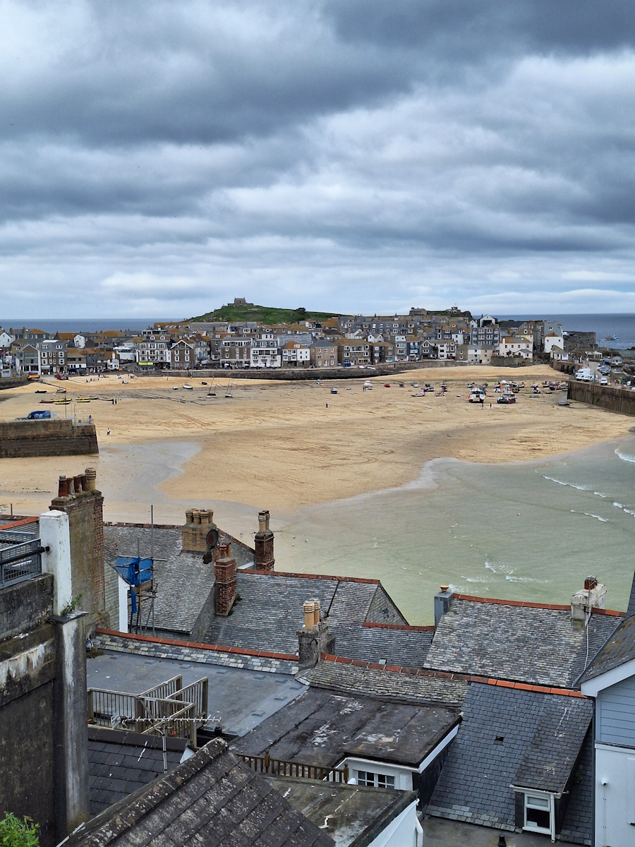
St Ives harbour
My accommodation for two nights – The Nook – was away from the town centre up a steep hill and not easy to find at the end of an un-named and unmade side track. I walked about half a mile past the turn until I found someone to ask who gave me directions. But I had a large and light ground floor room, and there was a communal sitting room and communal kitchen with cooking facilities for those who wanted. The whole place was unstaffed with access through a personalised security system. It worked well once I’d got used to it. That evening I walked down the hill and had a good pizza by the harbour at Onzo. There was a storm forecast overnight with strong winds and heavy rain lasting until mid-morning.
Comments
South West Coast Path – Day 21 — No Comments
HTML tags allowed in your comment: <a href="" title=""> <abbr title=""> <acronym title=""> <b> <blockquote cite=""> <cite> <code> <del datetime=""> <em> <i> <q cite=""> <s> <strike> <strong>