South West Coast Path – Day 37
Mevagissey – Par
27 September 2025
Distance on Coast Path: 16.5km; ascent: 489m
Total distance: 17.6km; ascent: 489m
Walking time: 5h 12′
Total time: 4h 46′
Overnight: AirBnB, Par
Sunrise
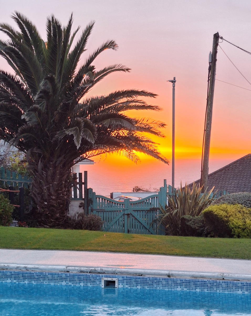
When I pulled back the bedroom curtains at about 7.15 I was delighted with a view of the sunrise, bright orange behind the fronds of a large palm tree. Sadly it didn’t last long (red sky in the morning?) and the rest of the day was dull and grey.
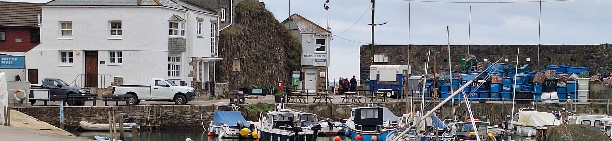
After breakfast I set off steeply downhill on the road into Mevagissey, a large village with a harbour, art galleries and craft shops. It was still early and I wanted to get going so I didn’t explore beyond the centre, though I did buy a flapjack for later.
The morning was a typical Coast Path morning – regular ups and downs, a mixture of cliffs, woods and fields, beaches and coves. I confess I took a shortcut to avoid the headland of Black Head with its rifle range and iron age fort, and pressed on to Porthpean where an inviting bench on a grassy knoll overlooking the beach gave me somewhere to sit and have an early lunch.
The Coast Path continues along a scruffy low sea wall (the SWCP guidebook calls it “the promenade”) at the top of Porthpean beach before taking a recently-built staircase with an ugly handrail of steel tubing to the top of the cliff.
The next place along the coast was Charlestown, which I was keen to reach for several reasons. I’d never heard of it; it had a very different name from the other Cornish harbour villages I’d passed through; I hoped to find somewhere for a coffee; I’d read it was a location for the Poldark TV series (which I’d never watched), and there were sometimes tall ships in the harbour. Descending past an old gun battery I came down to the village to find a row of shops and houses; an empty dock behind closed lock gates; stalls on both sides of the dock quay selling tourist stuff, food and drink; a derelict hulk resting on the mud at the bottom of the dock, and some large brick buildings on the opposite side. But no tall ships.
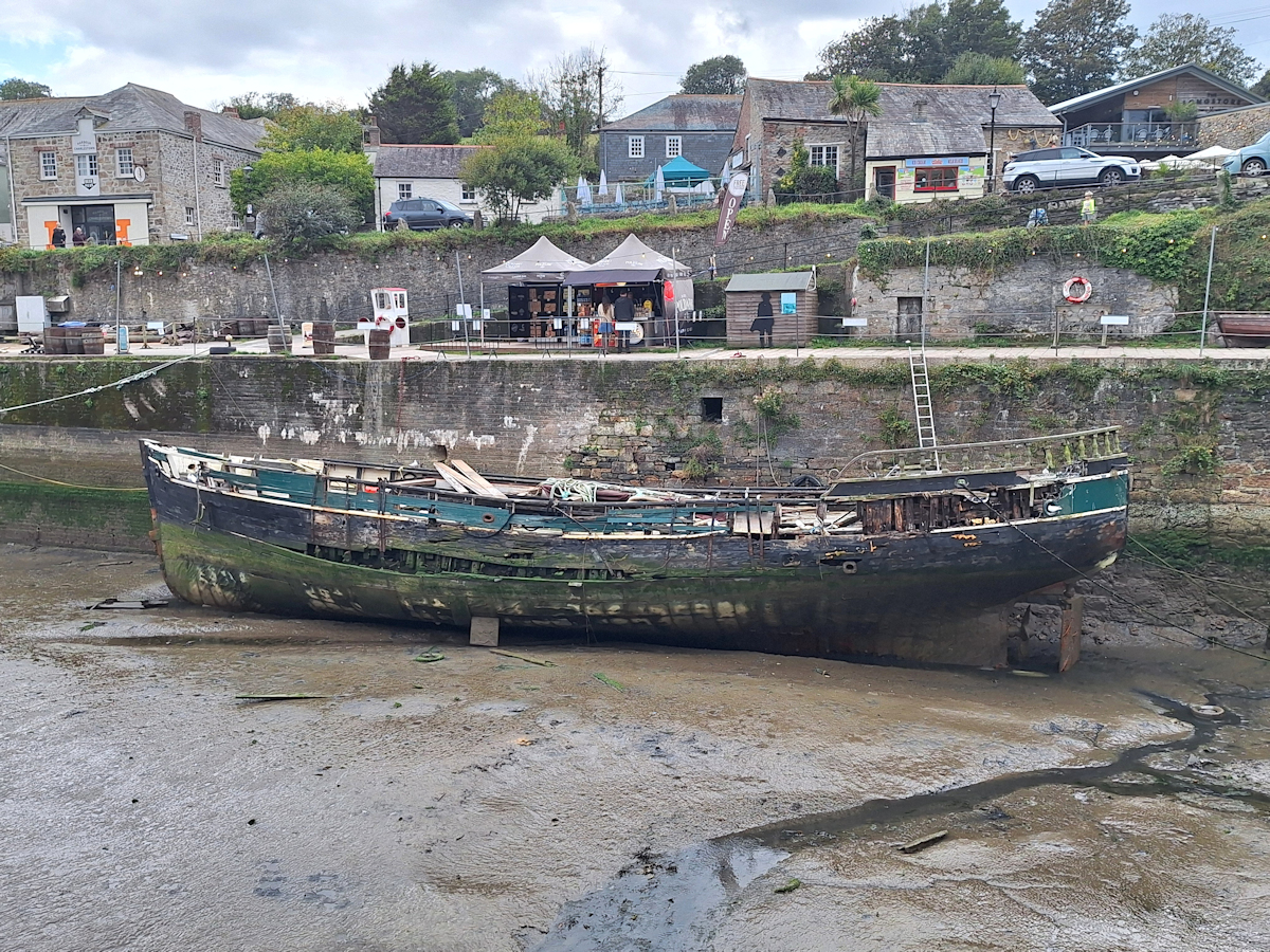
Derelict hulk in Charlestown dock.
I found a coffee place called “Short & Strong” where I sat inside and read the Wikipedia article about the village. Originally a tiny port where pilchards were processed, a man called Charles Rashleigh (yes, that Charles) developed the port and the village behind for the onward shipping of copper from nearby mines. The Wikipedia article has much more, including the gun battery and tales of embezzlement and bankruptcy.
Once back on the cliffs I came to a recent development of large houses where the path ran on the seaward side of a very expensive-looking fence high enough to stop passers-by seeing into the properties. The fence ran for the best part of a kilometre before the path opened up into a field which in turn led to the start of what might well be the longest and narrowest golf course in the country, Carlyon Bay Golf Club. Only a few hundred metres at its widest, and often much less, the course extends more than 2 kilometres along the coast. The Path follows the seaward edge of the course, sometimes on the course itself, otherwise on the outside of a low hedge. Each return to the course came with a warning sign about the danger from golf balls.
The golf course came to an abrupt end at a small beach called Spit Point. Ahead, large and bulky old buildings marked the entrance to the town of Par; the Path turned sharp left into a narrow tarmac footpath between high mesh fences. The land between the path and the buildings was overgrown; the whole place seemed run-down and semi-derelict although there was also the sound of heavy engines and machinery. Following the enclosed path through several sharp turns, alongside railway tracks and under bridges I eventually emerged onto a road close to the entrance to Par Docks. Although obviously still in use the dock entrance was both forbidding and forlorn: it didn’t need a sign to say “Keep Out! Go away!”
No longer true to its name the Coast Path headed along the road, under another railway bridge and past a pub, then turned right under yet another railway bridge and onto a residential road with houses on both sides. My AirBnB was in a self-contained and comfortable small annexe to one of these houses, so right on the Path.
Rest Day in Par
28 September 2025
Par is a strange place. It doesn’t seem to have a town centre as such, only occasional shops and services dotted intermittently along the residential streets. But there was a Co-op at the end of my street, and a pub – The Welcome Home Inn – almost opposite my AirBnB where I had a good meal the first night (for my second night I microwaved a takeaway from the Co-op).
Par is also a stop on the main Great Western Railway line to Penzance. Why is it there, especially when it’s only a couple of miles further to St Austell? One reason is that it’s where the branch line to Newquay on the north coast begins. But the other reason lies in Par’s history. Those unwelcoming and forbidding great buildings, and the docks themselves, were at one time the centre of the china clay processing and shipping industry and before that, in the early 19th century, copper was big business. The great buildings were where the raw china clay from the mines inland was dried before being shipped out.
Unlike nearby Fowey, [Par] cannot accommodate large ocean-going ships. The harbour is operated by the French mineral extraction company Imerys. Today china clay is piped to the harbour in slurry form; most is dried in large sheds before exporting either from Par or Fowey, the two being linked by a private road. One berth at Par can also load clay slurry into coasting vessels. The harbour also has a rail link that is used to carry away dried clay loaded in rail vans. A major reduction in china clay operations, announced on 4 July 2006, included proposals to close Par to commercial shipping and to close some of the clay dryers. The closures took effect in 2007.
Source: Wikipedia https://en.wikipedia.org/wiki/Par,_Cornwall
I spent my rest day – Sunday – wandering around Par and failing to catch a bus into St Austell. Par Sands turned out to be one of the less attractive beaches in Cornwall; a beach backed by a flat area of dune grass and scrub with a large holiday development of mobile homes behind. But I did find the small bridge half hidden in the undergrowth at the side of the car park at the far end of the Sands where the Coast Path continues on the next leg eastwards.
Comments
South West Coast Path – Day 37 — No Comments
HTML tags allowed in your comment: <a href="" title=""> <abbr title=""> <acronym title=""> <b> <blockquote cite=""> <cite> <code> <del datetime=""> <em> <i> <q cite=""> <s> <strike> <strong>